Shower and storm chances tick back up for the weekend
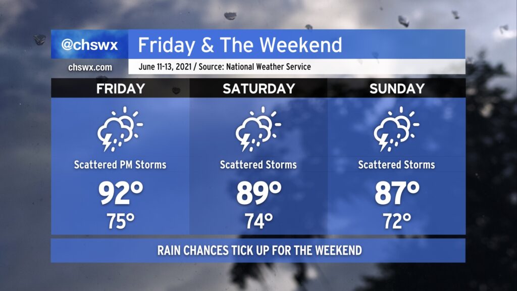
We have another hot day in store for Friday as temperatures once again head back into the low 90s in the afternoon. Humidity will make it feel closer to 100° once again, especially in the early afternoon. Like today, we can expect a few scattered showers and thunderstorms in the afternoon. Not everyone will get rain, but those who do could see a brief downpour along with some lightning.
As we get into the weekend, we will see a front start dropping into the area from the north as a trough digs in aloft. This will contribute to additional coverage of showers and thunderstorms during the day Saturday. Plenty of moisture in the atmosphere will allow for heavy rainfall to develop, and given that slow storm motions are expected, some minor areas of flooding are certainly possible. Look for highs near 90° before storms kick in.
The front will continue to sink south of the area as we get into Sunday. Alas, this isn’t the kind of front that gets us much in the way of a cooldown, and indeed, the front will dissipate as it continues to push southward. Still, expect scattered storms to continue to be a factor on and off during the day. High temperatures will once again run in the upper 80s before showers and storms begin to develop.
This unsettled pattern looks to continue into next week as a trough of low pressure persists in the east. Good news here is that there will be more chances for beneficial rain across the Lowcountry in that time, but let’s hope we don’t get too much of a good thing all at once, either.