Friday and the weekend: Storm chances return, and temperatures remain a little below normal
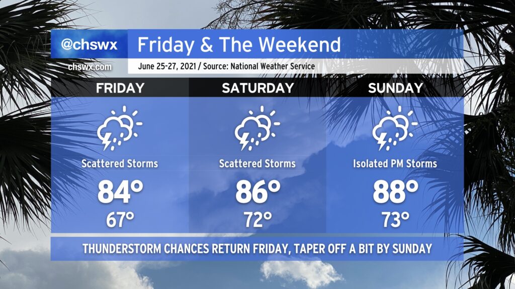
After a remarkably nice couple days behind a rare summertime cold front, said front retreats back over our neck of the woods as a trough of low pressure on Friday, bringing humidity, showers, and thunderstorms back into the weather picture. These elevated rain chances stick around to start the weekend before tapering off to more traditional isolated afternoon thunderstorm coverage on Sunday. Temperatures warm up from 84° on Friday to 88° on Sunday, but we are typically talking about 90s on a regular basis in late June, so we’ll take it.
One thing I’m not seeing is a total washout of the weekend by any stretch. Don’t cancel outdoor plans, just have a good backup ready to go in case you need it. Remember, all thunderstorms are dangerous because of the lightning they produce. If you see lightning or hear thunder, you’re close enough to be struck, so get inside as soon as you can if storms approach.
Coastal flooding will remain a possibility Friday and maybe Saturday nights as lingering astronomical influences and continued onshore flow could push tides above 7’ in the harbor in the late evenings. Be ready for additional bouts of coastal flooding and possible road closures as a result.