Rest of the work week: Scattered summer storms, evening coastal flooding
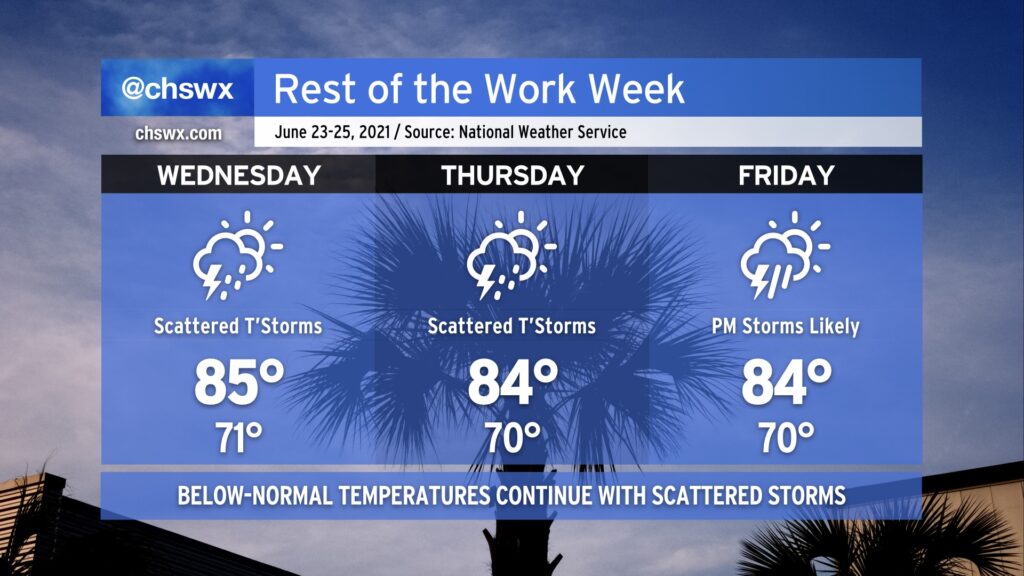
A cold front will pass through the area and stall out to the southeast as high pressure wedges down a little bit from the north. This will generate a bit of onshore flow, keeping temperatures in the mid-80s through the end of the work week. This will also combine with enhanced astronomical tides thanks to Thursday’s full moon to cause some minor to moderate coastal flooding each evening through at least Friday.
Scattered showers and thunderstorms will be possible each day through Friday, with the best chances coming along with the inland-moving seabreeze especially Wednesday and Thursday afternoon. By Friday, we’ll see an increased chance of thunderstorms as high pressure to the northeast gives way, allowing a trough of low pressure offshore to migrate inland and provide a sharper focus for precipitation to form.
With such saturated ground from a pretty rainy June thus far, we’ll want to watch any areas of heavy rain that develop for an isolated flooding threat. This doubly goes for times of the evening high tides due to the aforementioned king tides. With that in mind, the good news is that it won’t rain all day, every day, and not everyone will see rain every day, either.