The week ahead: Settling into a standard summertime pattern
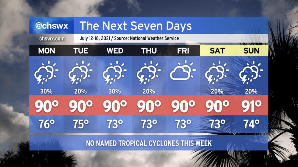
For the first time in three weeks, we do not have any concerns about a tropical cyclone influencing our forecast. Hooray! We’ll have a much more typical July week of weather ahead featuring temperatures around 90° each afternoon and a chance for isolated to scattered storms pretty much each day, mostly in the afternoons (though Monday could get started and end a little earlier). The only severe weather that might occur this week would be where thunderstorm outflow boundaries interact and enhance lift, perhaps bringing a brief damaging wind threat via downburst winds. Atlantic high pressure building across the area will otherwise put a lid on more widespread shower and thunderstorm activity.
Southerly winds around the high will give us a little bit of an onshore component to the wind, which will help regulate temperatures to near normal levels. We won’t be able to escape the 70s dewpoints, though, so be ready for heat indices in the upper 90s to near 100°, especially around the time the seabreeze circulation passes your location.