Friday and the weekend: More of the same ahead of a pattern change
Atlantic high pressure and ridging aloft remains in control of our weather for a few more days before a pattern change greets us with increased chances for showers and thunderstorms for the new work week.
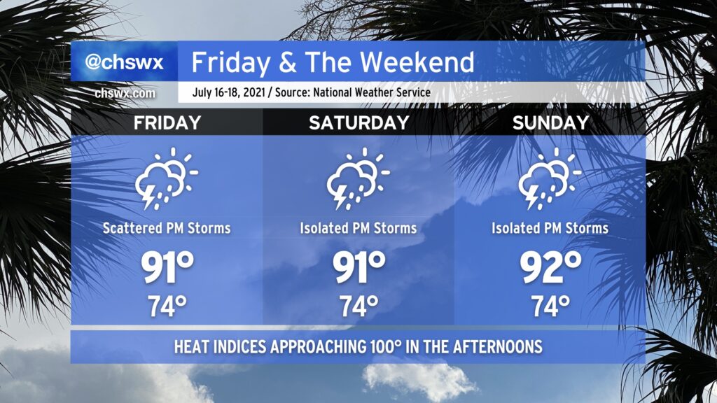
Temperatures through the weekend will top out in the low 90s each afternoon, but low-to-mid-70s surface dewpoints will make it feel a little closer to 100°. We’ll see the standard mid-July isolated to scattered coverage of showers and thunderstorms ahead of the inland-advancing seabreeze each afternoon. You can never totally rule out a strong wind gust or two to cause problems with any summertime thunderstorm, but the risk for severe weather looks quite low. This setup should yield a few good, if not hot, beach days — pretty much exactly what we should expect this time of year.