Heat indices exceeding 110° — possibly approaching 115° — possible Friday
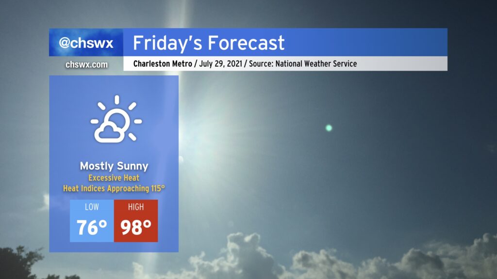
Friday will be the hottest day of 2021 so far. Temperatures will soar into the upper 90s in the afternoon as deep westerly to northwesterly flow in the troposphere pins the seabreeze to the coast, keeping the cooler marine air at bay for much of the day. On the other hand, this will allow very humid air characterized by dewpoints approaching 80° to pool near the coast. When the seabreeze finally begins its inland trek in the mid-to-late afternoon, the highest heat indices will then be realized as this incredibly moist air moves across the much warmer air found over land. Given this potential, an Excessive Heat Watch is in effect for the Tri-County area. Ridging aloft will put the kibosh on any shower or thunderstorm activity, so don’t count on that to bring any relief, either.
If it’s at all humanly possible, avoid exertion in the heat of the day tomorrow. If you must be outdoors, get shade and hydration on a very regular basis. If you begin to feel ill, move into an air-conditioned area immediately. If you feel faint and your skin is hot to the touch, that’s quite possibly heat stroke — a 911-worthy medical emergency requiring swift treatment.
High heat will continue through Sunday, and heat advisories for heat indices approaching 110° are certainly possible. Please take it easy!