Mostly quiet day, but storms still could fire soon across the metro area
Storms have remained mostly at bay today (aside from a few popups in the Walterboro/Summerville corridor) as we put in another hot day with highs topping out at 95° at the airport and 92° at Downtown.
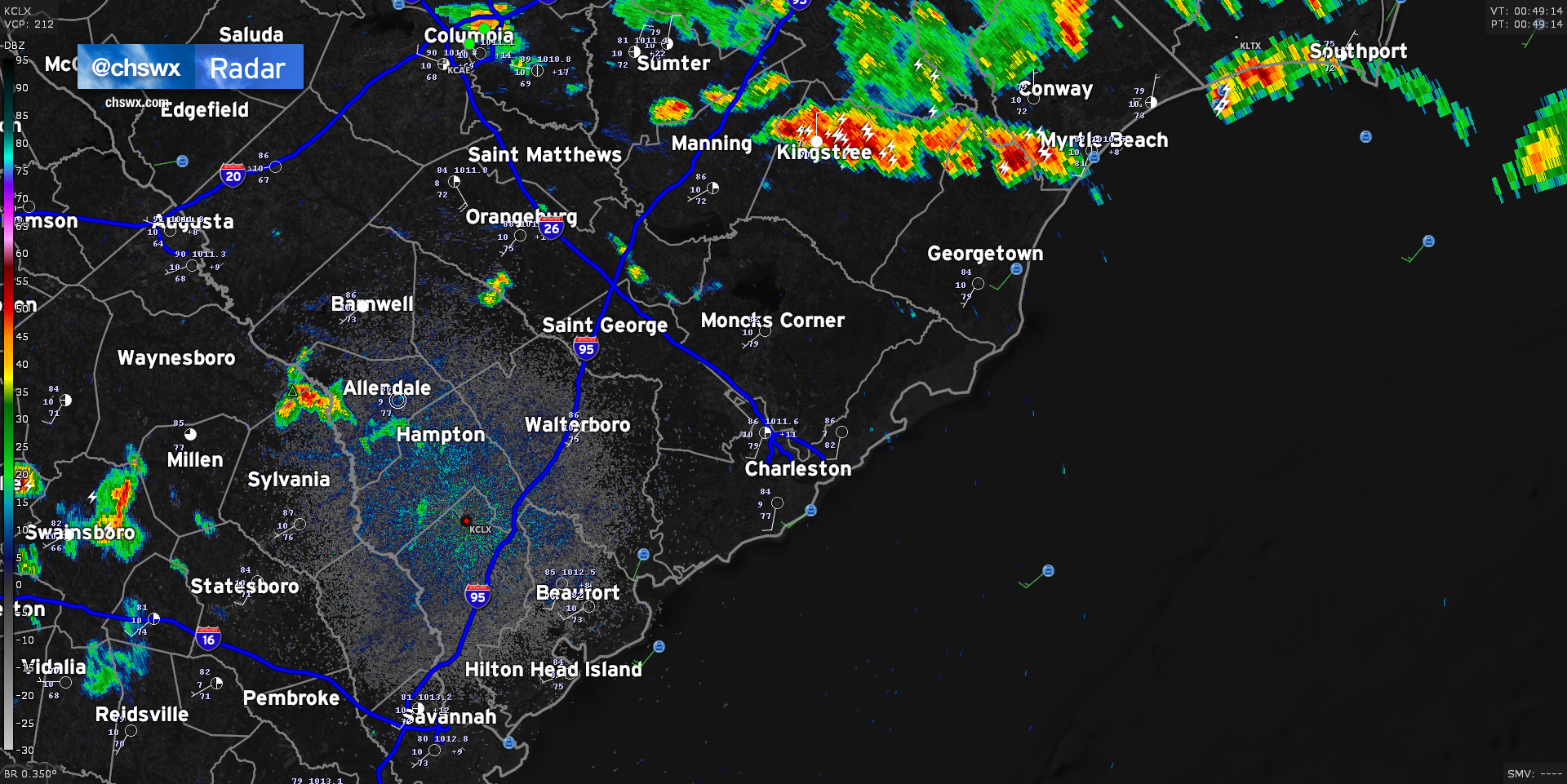
We’ve seen showers and thunderstorms essentially split the area so far today; severe thunderstorms with even a few tornado-warned cells fired up in North Carolina, while a separate round of convection has been ongoing in far southern Georgia into Florida. This has kept the Charleston Metro Area fairly quiet, but I suspect that will be changing fairly soon as a frontal boundary continues its southward trajectory across the state. Radar is doing a good job at picking out an outflow boundary cutting through the Midlands right now, which has caused storms to fire in the Columbia metro area.
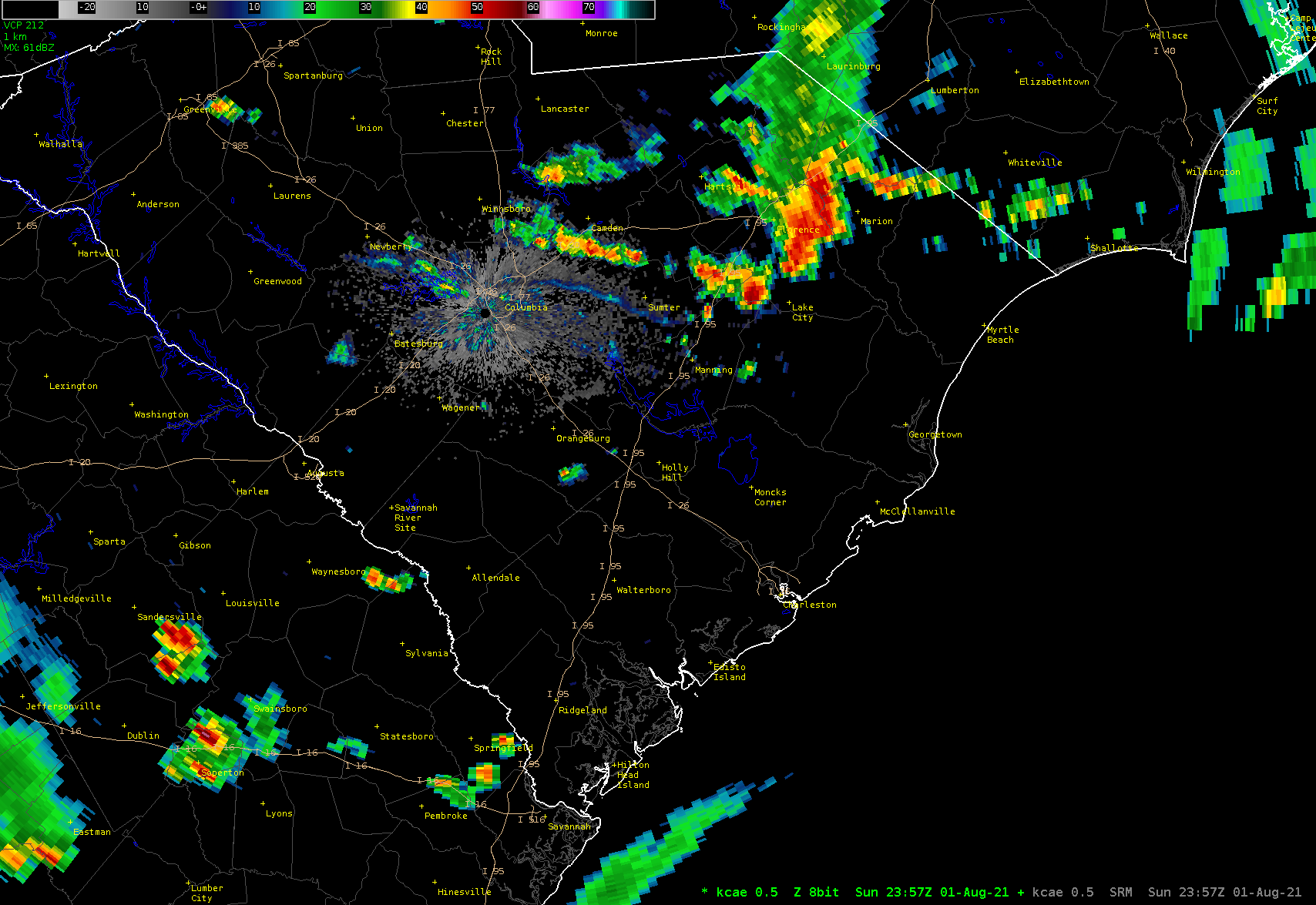
This outflow boundary is approaching a few smaller popup storms in Orangeburg and northern Berkeley counties. The atmosphere over Charleston continues to be fairly ripe for thunderstorm development, and short-term models continue to indicate additional shower and thunderstorm coverage developing in the I-95 corridor by 10PM. With the loss of daytime heating, instability has been waning, but there is still more than enough fuel for some loud and rainy thunderstorms in spots tonight.
The front helping to drive all this will stall out across the area tomorrow. With plenty of available moisture and instability, we’ll see several rounds of showers and thunderstorms over the next few days. I’ll have more details in another post later this evening.