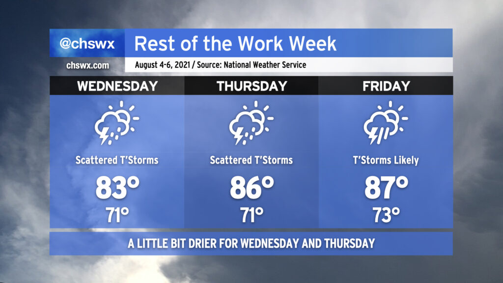
Rest of the work week: A little drier Wednesday and Thursday, temps remain below normal

There’s a reason we tell y’all to stay tuned to forecast updates, and that’s because sometimes things change. In this case, it’s changing for the better thanks to a front that pushed a little further south and a trough moving a click or two more eastward.
Wednesday: Trending cooler and more rain-free
Guidance trends have had high pressure nudging in a little further south than first thought for Wednesday as low pressure departs to the north. This, combined with the upper trough that’s been causing some of our troubles shifting a little more eastward, should produce a somewhat nicer day than expected as the best moisture and lift shift offshore. Indeed, models continue to trend drier for much of Wednesday as they depict the front perhaps sinking as far south as southern GA. We’ll see how this ultimately plays out with the overnight guidance, but it is possible that many of us may get much of Wednesday in high and dry. (I’d still be ready for some scattered storms near the coast, though, given the proximity to the front.)
The other cool part about this front is the temperatures: We’ll only top out around 83° on Wednesday as northerly winds bring in some cooler and slightly drier air. This is well below normal for early August, and after last week’s excessive heat, we’ll take what we can get!
Thursday: Warming a little, front continues to meander nearby with shower chances
We could see a little more shower and storm coverage on Thursday, but this is once again very dependent on where the front ends up and the timing of any waves of low pressure riding along it. The evening model guidance continues to keep us mostly dry on Thursday, save for some scattered showers and maybe a thunderstorm particularly near the coast. Temperatures look to moderate a bit back into the mid-80s, but we remain well below normal for this point in the year.
Friday: Front moves north, a little warmer with storms becoming likely
As the first upper trough — responsible for today’s wet weather — lifts out late Thursday/early Friday, another trough looks to dig back in and help lift the front north of the area. We’ll be back in the right-entrance region of said trough, which is a more favorable location for precipitation to develop, and with the surface boundary giving the atmosphere a kick, expect showers and thunderstorms to increase in coverage particularly in the afternoon and evening hours. Temperatures will rebound a bit back into the mid-to-upper 80s, but rainfall should still keep temperatures a few clicks below normal.
Caution: Tricky forecast
I’ll close by reiterating that this forecast is pretty tricky. Stalled fronts can play spoiler to even the best-reasoned forecast, and so it’ll be important to stay up to date with the latest information as the week goes on. Stay tuned!
Follow my Charleston Weather updates on Mastodon, Bluesky, Instagram, Facebook, or directly in a feed reader. Do you like what you see here? Please consider supporting my independent, hype-averse weather journalism and become a supporter on Patreon for a broader look at all things #chswx!