Friday & the weekend: Warmth and humidity return along with rain chances
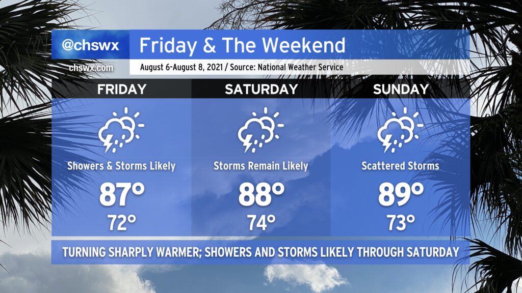
After two straight days of 70s — the earliest that’s happened in August on record — a warm front will lift across the area late tonight into Friday morning. Said warm front will scour out the cool season-esque wedge of high pressure that’s been in place for the last couple days and bring warm temperatures and humidity back to the Lowcountry. This, too, combined with good mid-level forcing from a trough approaching from the west, will keep plentiful showers and thunderstorms in the forecast through Saturday.
With the wedge scoured out, we shouldn’t have quite as much overcast as we’ve seen the past few days. The change in airmass and ensuing periods of sunshine between storms will allow high temperatures to rise through the upper 80s each day through Sunday. Mix humidity in, and it’ll feel closer to the mid-90s on Friday, and will feel closer to 100° Saturday and Sunday afternoons. (At least it’s not 115° like this time last week!)
The trough that’s responsible for Friday and Saturday’s shenanigans will shift eastward as Sunday goes on, giving way to weather that’s more characteristic of early August to start the next work week. The fall preview was nice, though, and it’s a nice reminder that we’re coming through the peak of summer now, with the cool season not too terribly far off.