Showers skirting the coast this morning; more scattered showers and storms later today
We woke up to some fairly rude shower activity generally along and east of 17-A this morning as the front repositioned a little further north. Lift across the boundary within an enhanced corridor of moisture is keeping us in cloud cover and showers this morning. We could see another round of showers in the next couple hours lift out of Savannah into the metro area. Guidance continues to indicate a dry slot for at least a few hours late this morning into early afternoon, but then begins to advertise scattered showers (and maybe a thunderstorm near the coast) returning to the picture later this afternoon.
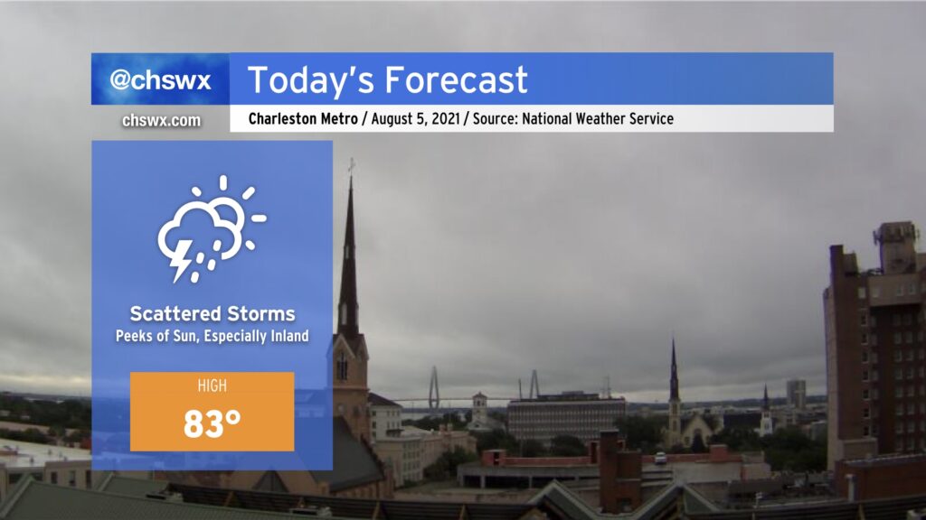
We could still see some peeks of sun throughout the day, but the best chances of that are going to be further inland, generally west of 17-A to the I-95 corridor. Closer to the coast, we’ll remain within a plume of higher precipitable water values and somewhat better forcing in proximity to the front, which will certainly make it tougher to get some sunshine through. Depending on the strength and timing of the high pressure wedge lifting out, this could make for another significantly cooler-than-normal day for much of the Charleston metro area.
By tonight, rain chances will spread further inland as the front begins to lift back to the north in response to a trough, currently found over the Midwest into the southern Plains, pushing eastward. This will increase rain chances markedly for tonight into Friday.