Off-and-on rain the norm today as Fred skirts to the west
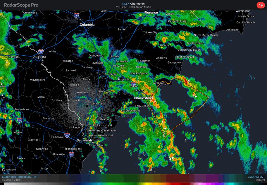
Showers and thunderstorms will rotate northward through the area throughout a good bit of today as Tropical Depression Fred lumbers up through Georgia into the Upstate. It won’t rain all day — these showers and storms will be transient in nature, and thankfully will be moving quickly — but when you do get caught in one, a quick inch of rain in a short time is not out of the question, which may cause drainage to become overwhelmed and isolated flooding to occur. The good news for the morning commute is that low tide comes up a little after 9:45am.
This evening, short-term guidance is hitting on more scattered shower and thunderstorm activity as Fred’s center moves north of our latitude. We’ll keep the deep tropical moisture in place, though, and there is the potential for heavy downpours to develop in spots. High tide this evening comes up at 4:26 PM. It’ll be a little higher than normal, too, so any rain that falls around this time could certainly contribute to brief flooding issues.
All the while, I wouldn’t be totally shocked if we saw a little bit of sunshine peek out from time to time as a dry slot moves northeastward out of southeast Georgia and along the South Carolina coast.
Severe weather looks very unlikely today across much of the area as the greatest overlap of instability and shear associated with Fred’s circulation remains to our west. The Storm Prediction Center’s highest tornado probabilities are situated in the Upstate northeastward into the North Carolina Piedmont. A spin-up can’t be ruled out as far east as the I-95 corridor, but we in #chswx aren’t anticipating major issues here in our part of the Lowcountry. Of course, we’ll keep an eye on this in case things change.