The week ahead: Return of Augtober
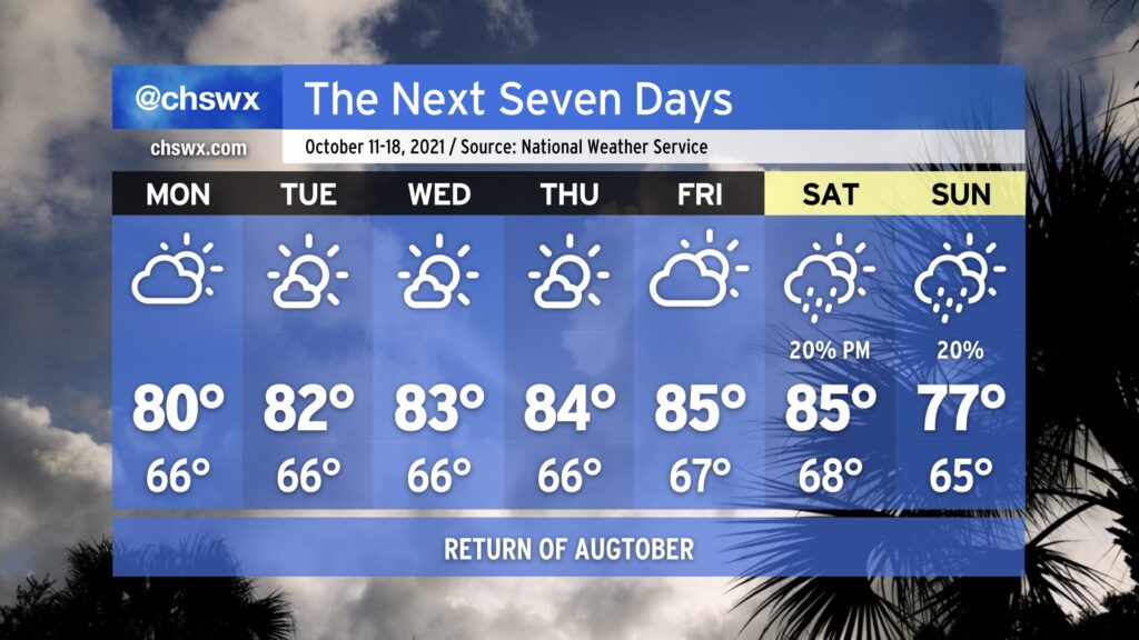
The upcoming week looks much more rain-free than the past week was, as ridging aloft builds across the area. Said ridging will drive temperatures up toward “Augtober” levels by the end of the week — mid to upper 80s will be possible, challenging record highs — but the good news is that humidity will remain tolerable. Monday looks to be a rather nice weather day as we begin the day in the mid-60s and top out in the low 80s with a mix of sun and clouds, a lot like what we saw Sunday.
A front looks to get by the area sometime during the upcoming weekend, and that will have a bit of a downward effect on temperatures, with highs in the 70s in the long range as we get into next Sunday. There are some hints of a little more crisp fall weather as we get into early next week, but we will need to see how things pan out with the front and high pressure behind it. Stay tuned.
Finally, coastal flooding issues will taper off early this week, but minor flooding will be possible once again an hour or two around the 12:46 PM high tide on Monday. This could close a few roads in downtown Charleston, especially near the Citadel and MUSC. The current forecast has some lingering effects for the Tuesday afternoon high tide as well, but it remains to be seen if winds will be enough to push us over the 7’ threshold.