Friday & the weekend: Cooling off, clearing out
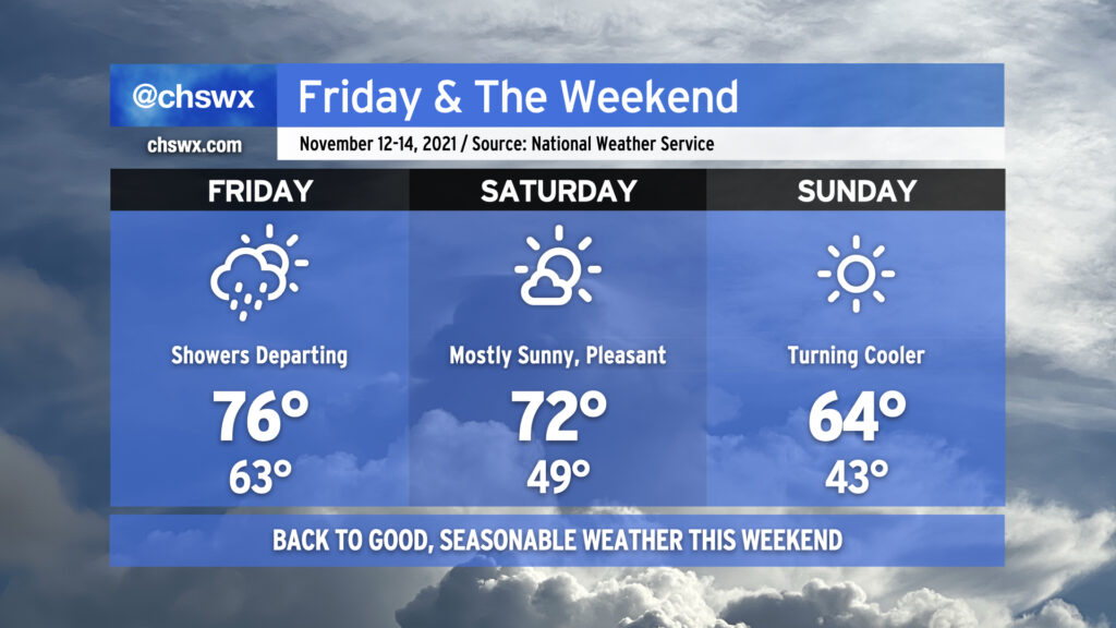
We’re back to nice weather this weekend as a series of dry cold fronts move through, reinforcing progressively cooler and drier air as time goes on. Any leftover showers should be departing with the front Friday morning, and despite frontal passage, we should still warm into the mid-70s but with lower dewpoints spreading into the area. Winds out of the west and northwest could have a little downslope component to them, which will aid in warming us a few degrees above normal for the afternoon.
Saturday looks excellent, with mostly sunny skies and temperatures around or just a hair above normal ahead of another front that looks to get through the area later in the evening. This front brings in another shot of cooler and drier air for Sunday, which certainly could prompt a sweater weather watch with highs in the mid-60s despite full sunshine. Overall, I would say this weekend’s weather will dramatically outclass the mess that was last weekend.
While we reached minor flood stage once again in the harbor early this afternoon — eight consecutive days of coastal flooding, for those of you counting at home — the risk for additional coastal flooding is extremely low going into Friday and virtually nonexistent heading into the weekend. (And thank goodness for that.)