Friday & the weekend: Turning cooler once more
A cold front will approach the area tonight, bringing with it periods of cloud cover that will occasionally obscure the view of the partial lunar eclipse (beginning around 2:30am, peaking at 4am, and ending around 5:30am). However, given that much of this cloud cover will be higher-based, it could make for some rather dramatic photography even though the moon won’t be completely clear. Something to think about as you consider your plans tonight!
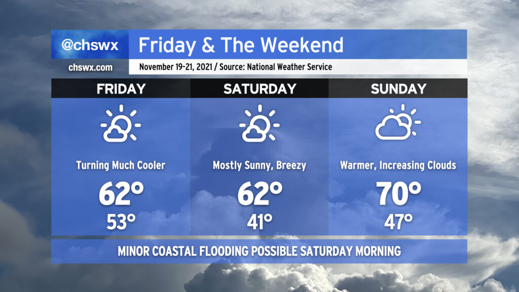
Said cold front moves through the area around daybreak Friday, and brings with it much cooler and drier air — expect highs to only top out in the low 60s despite mostly sunny skies. We’ll have more of the same on Saturday, with high pressure wedging southward a bit and kicking up northeasterly winds to yield wind chills in the low 30s in the morning before warming back to just the low 60s once more. High pressure will slip offshore quickly, though, and by Sunday we’ll feel warmer temperatures in the upper 60s to around 70° as return flow from the southwest increases ahead of another quite potent cold front that’ll swing through to kick off the abbreviated Thanksgiving work week. How potent, you ask? It may very well be enough to bring the season’s first freeze to inland locations. Highs could struggle to the low 50s next Tuesday if current forecasts pan out. Stay tuned!
There will be an outside shot at some minor coastal flooding Saturday morning given the winds shifting around to the northeast and the full moon helping to elevate astronomical tides somewhat. Right now, the forecast falls just short of the 7′ mean lower low water level that marks the coastal flooding threshold, but we’ll keep an eye on it. Thankfully, this will not be anywhere in the ballpark of the major flooding event we experienced a couple weekends ago, and the threat for coastal flooding will be relatively short-lived as winds promptly go offshore on Monday after frontal passage.