Warm weather closes out 2021, shower chance Thursday
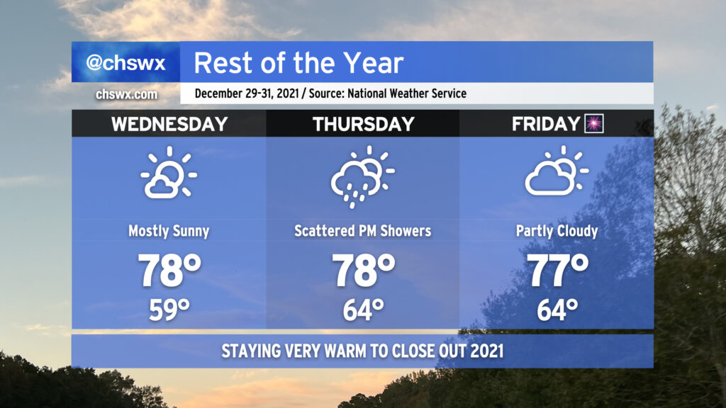
2021 is going to close out on a very warm note for the Lowcountry. At the surface, subtropical high pressure will hold firm while the flow aloft continues in a zonal pattern, resulting in an inability to get any fronts through here until the first of the year.
We’ll have at least one or two more opportunities to break record highs before 2021 is all said and done. Wednesday should feature a little less cloud cover, allowing temperatures to challenge the record high of 79° set in 2015. Despite the possibility of some scattered showers Thursday as an upper disturbance ripples by, temperatures should still warm into the upper 70s. (This will fall short of the record of 82°, though, set in 2015.) Partly to mostly cloudy skies return Friday with highs in the upper 70s once again getting close to the record of 78° set in 1996. Indeed, it would be a fitting end to a year that started with a record high — 80° on New Year’s Day.
How December 2021 stacks up, warmest-on-record edition
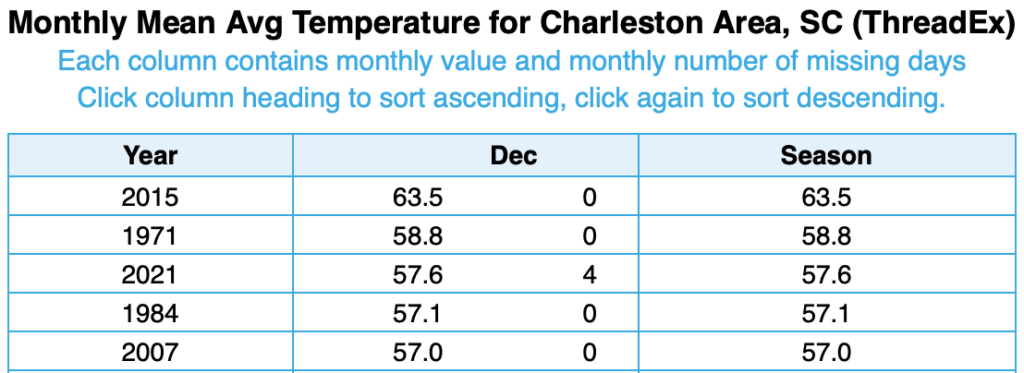
With four days left to factor into the tally, 2021 is settling into a good pace to be at least the third-warmest December on record with an average temperature to this point of 57.6°. 2015 remains the undisputed champion with an average temperature of 63.5°, while 1971 comes in a distant second with an average temperature of 58.8°. Rounding out the top five are 1984 and 2007 (tied with 1956 and 1982) with average temperatures of 57.1° and 57.0° respectively.
Stormy start to 2022 ahead
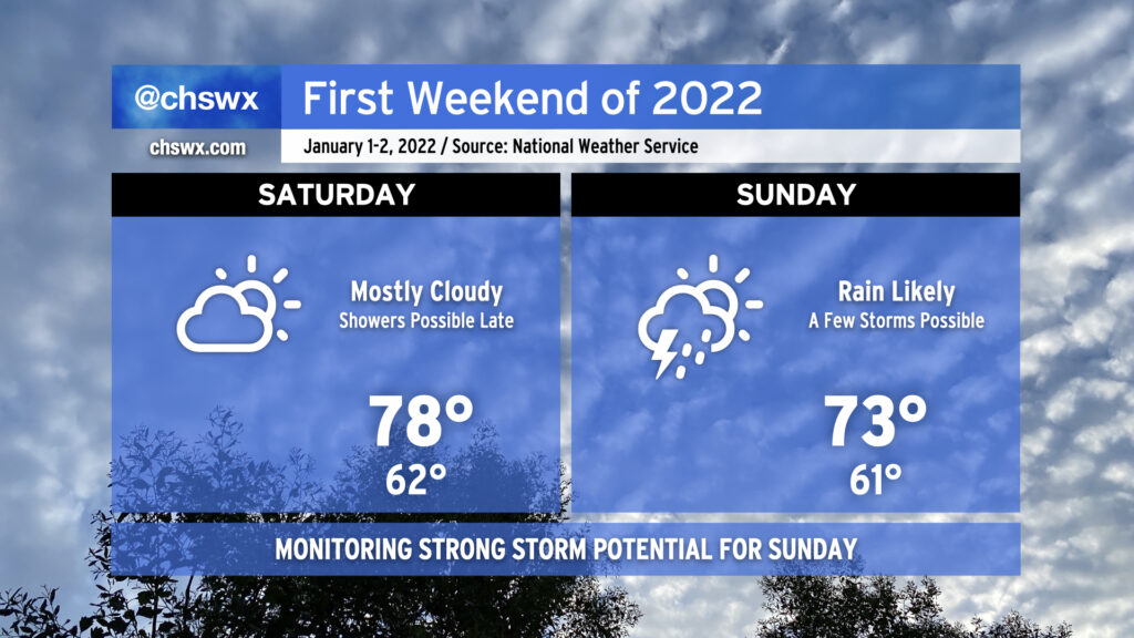
As I mentioned earlier, changes are in store as we get into 2022. We’ll have one more really warm day as Saturday will get within striking distance of the record high of 80°, set just this past January. Also at that time, we’ll be watching a potent upper-level disturbance slide across the Southeast. This feature will (finally!) drive a cold front into the area by Sunday, bringing with it a likelihood of showers and maybe even a few thunderstorms, a couple of which could be on the strong side. Once the front is through, Winter returns to start the first work week of 2022 as Monday’s highs look to only top out in the mid-50s.
Stay tuned to forecast updates as we head into the weekend as rain and thunder potential come into better focus.
Follow my Charleston Weather updates on Mastodon, Bluesky, Instagram, Facebook, or directly in a feed reader. Do you like what you see here? Please consider supporting my independent, hype-averse weather journalism and become a supporter on Patreon for a broader look at all things #chswx!