Saturday: Flurries possible in the morning, but cold a certainty
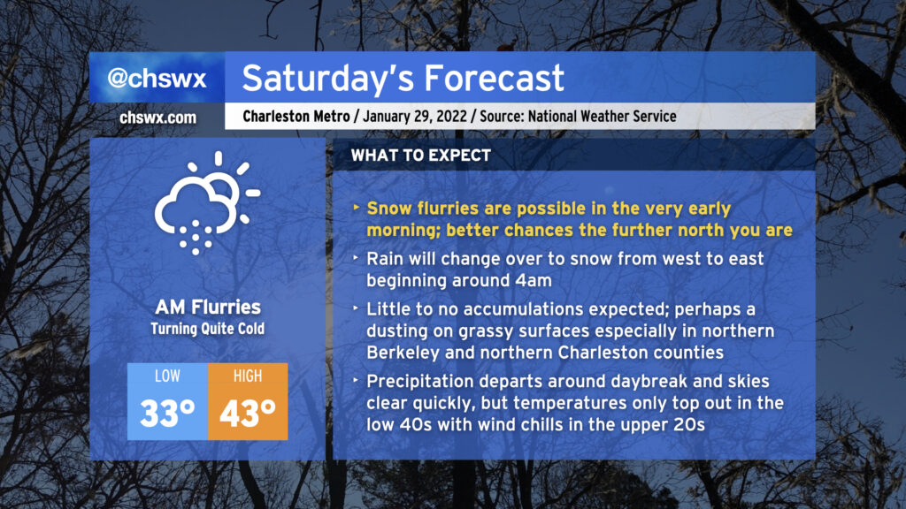
No point in burying the lede: Yes, we do have a legitimate shot at some light snow very early on Saturday morning. If you’re looking for your best chance to see snow, you’ll need to get up pretty early — general thinking around timing the change from rain to snow is generally from 3-5am from west to east.
There’s inherent uncertainty in where flakes will fly. We’re likely to see our best snow in northeastern Berkeley County and far northern Charleston County, where a couple hundredths of an inch could accumulate primarily on elevated and/or grassy surfaces. Further south into the Charleston metro area, precipitation looks to lighten up and taper off as moisture is stripped out of the atmosphere. It’s here where my confidence in whether we even see flurries is lower — a lot will be determined by the path of the upper low over the next few hours. In all cases, though, it is unlikely that we will see any problems.
Precipitation looks to depart generally around daybreak, though the further north you are, the longer it might linger as light snow. Once the snow is gone, attention turns to the surge of Arctic air in the wake of the strengthening coastal low pressure that is going to bring a blizzard to a fair number of people in New England. Highs will only top out in the low 40s, and it’s conceivable that wind chills could be in the 20s well into the afternoon. Air temperatures get that low for Sunday morning as another cold day is on tap before a warming trend evolves beginning Monday.
Let me know what you’re seeing tonight into tomorrow morning if you end up trying to wake up early for this — just make sure you’re bundled up!