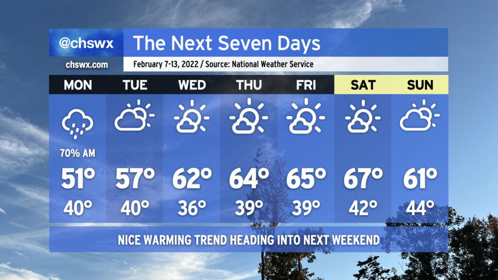
The week ahead: Showery start, but mostly sunny and increasingly warm thereafter

This week’s forecast is largely straightforward and gets better as the week wears on. We’ll get much of the rain out of the way Monday morning, with shower chances diminishing heading into the evening as coastal low pressure departs. Monday’s going to be the chilliest day of the set with highs struggling to crack 50° thanks to the showers and persistent cold wedge.
Cloud cover and maybe a shower or two will linger to start Tuesday, but we’ll be trending clearer as the day goes on. Highs top out in the mid-50s. From there, temperatures begin to trend at or even above normal with several days of quiet weather on tap from Wednesday to at least Saturday if not beyond. There is a little model noise around some rain in the area by next Sunday, but agreement and consistency is meh at the moment. For now, the NWS forecast maintains dry but slightly cooler weather for Sunday. We’ll keep an eye on that in case it changes!