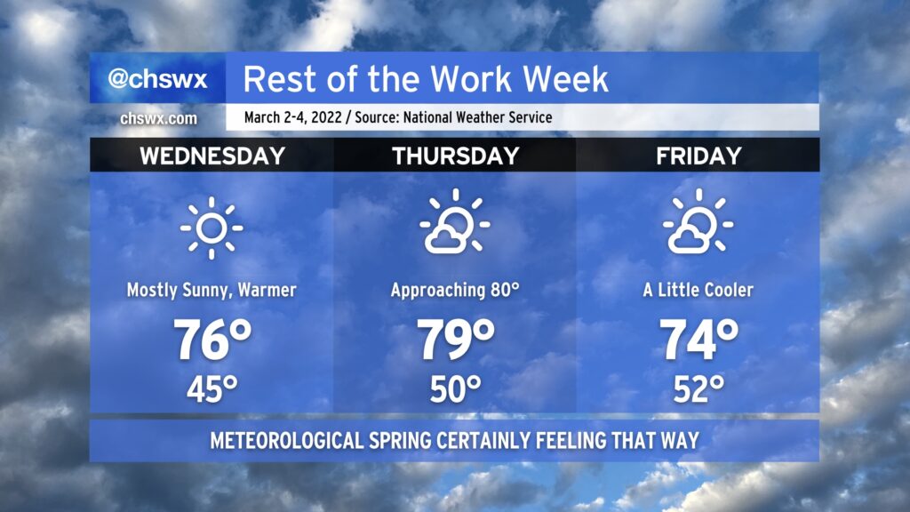
Rest of the work week: Meteorological spring in full swing

After topping out around 70° today, temperatures will aim ever warmer for Wednesday and Thursday before a dry cold front knocks temperatures down a bit for Friday. Mostly sunny skies will be the rule throughout, and with winds more out of the west, the risk for coastal flooding will decrease, too. Weather looks to get even warmer as we get into the weekend, too, with rain chances maybe returning to the forecast next Tuesday.
We’re getting close to the last freeze dates of the season (the median last freeze at North Charleston is March 8), but we can still have bouts of freezing temperatures well into early April, so be cautious if you begin planting. To that end, though, the National Weather Service has restarted the frost and freeze program as of today, which means Frost Advisories and Freeze Warnings will once again be issued by the NWS office when conditions become questionable for vegetation. If those end up being needed at any point, I’ll pass them on.
Enjoy the rest of a rather nice week!