Saturday: Wild day of weather starts with severe storms and ends with an Arctic blast
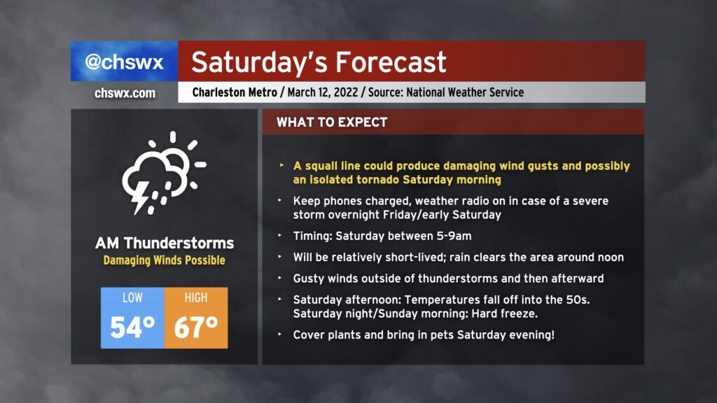
Saturday could be a bit of a wild day of weather across the Lowcountry. We’ll start with a strong cold front bringing a risk for strong to severe thunderstorms in the morning, and we’ll finish with Arctic air rushing into the area, leading to a hard freeze for many of us Sunday morning.
Morning severe weather threat
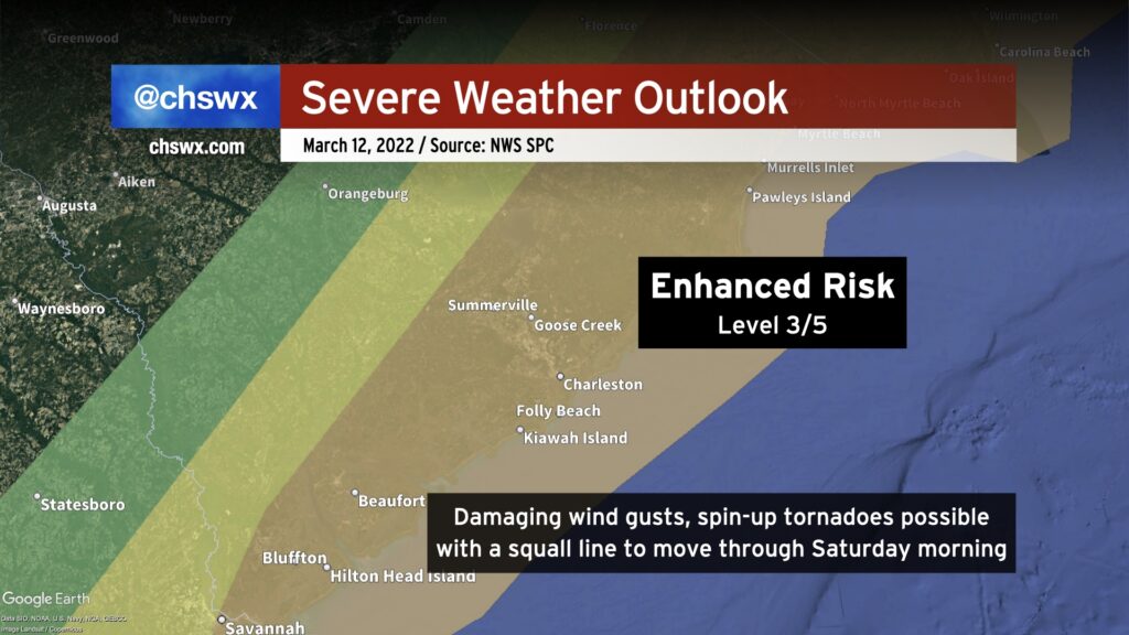
As mentioned above, the cold front will come through during the day Saturday. Ahead of the front, a squall line is expected to develop and march to the coast during the morning hours. With plenty of energy aloft to work with and the potency of the cold front, thunderstorms could overcome a relative lack of instability to produce damaging wind gusts. It is also possible that a brief tornado or two could spin up along the leading edge of the line and around bowing segments. The main threat, by far, is going to be straight-line wind. Even outside of thunderstorms, expect gusts to 40 MPH before and after the front passes.
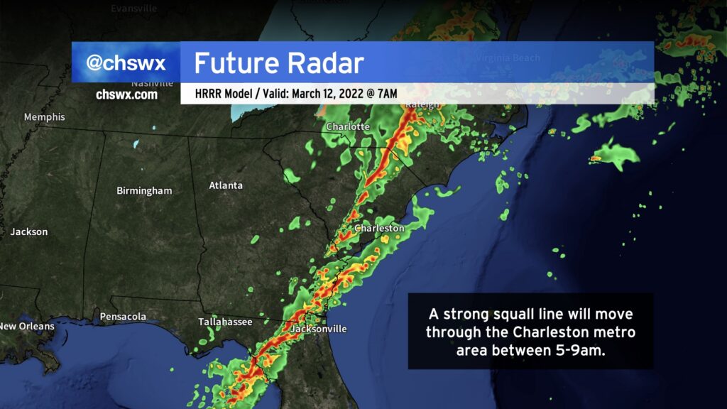
Timing on the line, based on model projections, looks to be anywhere between 5am near I-95 to 9-10am near the coast. The worst of the weather will be relatively short-lived as the line barrels east, though, and the rain should clear the area by noon, with clearing following.
Tonight, you should bring loose items in ahead of the storms so that they don’t end up in your neighbor’s yard (or worse) tomorrow. Be ready for power outages by having your phones charged. Keep a flashlight nearby in case there are power issues ahead of sunrise, too. If you have a weather radio, it’s a good idea to keep that nearby and ready to alert you, especially the further inland you are, just in case of a severe storm while you sleep.
Hard freeze expected for many of us Saturday night and Sunday morning
After the cold front gets through, temperatures will drop pretty quickly into the 50s on Saturday afternoon despite increasing sunshine. It’ll be windy — gusts 30-40 MPH are certainly possible — as strong high pressure builds in from the west.
The Arctic airmass will be strong enough to produce lows in the mid-20s inland to around freezing even near the coast on Sunday morning. Please be sure you are protecting pets and plants Saturday night — this freeze has the potential to set back a lot of early-starting gardens courtesy of another abnormally warm February.
The good news is that this is March, and such cold snaps are typically short-lived; we’ll be back in the 70s by Tuesday.