Friday & the weekend: Rough start, then getting quite cold
This weekend’s weather encapsulates the power of March in a nutshell: Cold air damming, followed by a severe weather threat, followed by an Arctic blast.
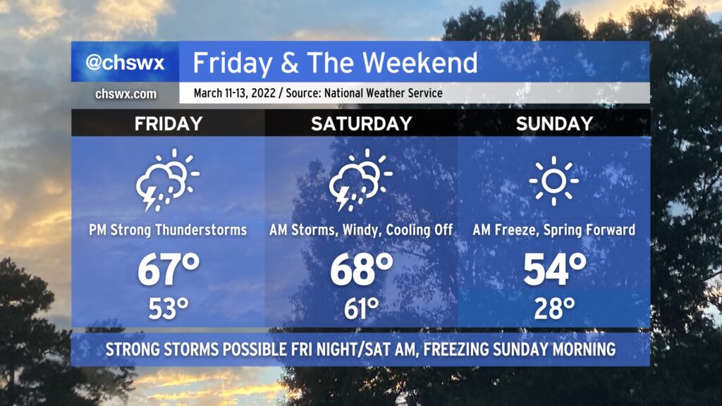
We’ll start Friday within the cold wedge that’s kept it cloudy and chilly across the area today. During the day, a warm front should lift north of the area, scouring out the wedge and putting us back in the warm sector of an approaching storm system. Showers and thunderstorms will be on the uptick as the front approaches, and a few of those could turn strong to severe especially as we get into Saturday morning. Guidance is pretty consistent in depicting a squall line-like feature moving through the area to start Saturday, promoting a damaging wind threat. A tornado or two could be possible inland as well, with that risk decreasing as you get closer to the coast and significantly cooler shelf waters.
After the front gets through Saturday morning, conditions will turn quite windy by afternoon as Arctic high pressure builds in from the northwest. The high temperature will be attained in the morning as we’ll cool off fairly substantially post-frontal passage, with temperatures just in the mid-50s in the afternoon.
Saturday night into Sunday morning, clocks will spring forward and temperatures will fall way back into the 20s in much of the metro area, with freezing temperatures possible to the coast. I’d advise everyone with tender vegetation to be ready for a freeze regardless of where you are; cover or bring in those sensitive plants and do not forget about your pets, either!
The chill will be short-lived heading into the new work week; we’ll be back in the 70s by Tuesday (along with another storm system).