Tuesday: Turning warmer and cloudier ahead of a couple unsettled days
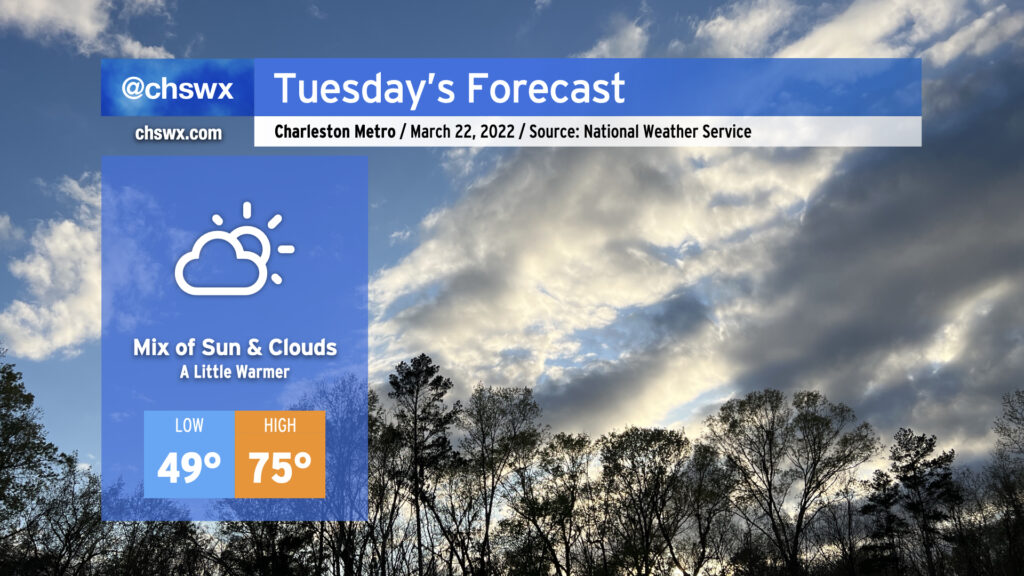
High pressure will continue to slip offshore overnight into Tuesday, allowing warmer and a little more humid air to keep working its way into the area. We stay rain-free on Tuesday, though, despite an increase in cloud cover. Highs top out in the mid-70s. Perhaps it won’t be the most picturesque day like we’ve had over the past couple days, but it will certainly be another decently nice day across the area.
Attention then turns to Wednesday, where there remains a risk for some severe storms that’s largely conditional on the timing of a cold front coming through the area. We’ll have the shear in place, but once again the question is instability and whether it will be available by the time forcing for ascent arrives. If the front gets closer earlier in the day, that could provide the necessary trigger for thunderstorms to develop and take advantage of that energy (though the amount of energy that would be available doesn’t look overly impressive). If it’s later in the day, though, we’ll see that instability begin to wane; as a result, the severe threat could be tempered somewhat. We should get some more clarity on the timing issues tomorrow; for now, prepare for a wet Wednesday with the potential for a few strong to severe thunderstorms. Hail, high winds, and a tornado are all on the table if in fact storms can get cranking, but as we know from recent days, that can be a big if. Stay tuned…