Showers, thunderstorms, and gusty winds for Thursday
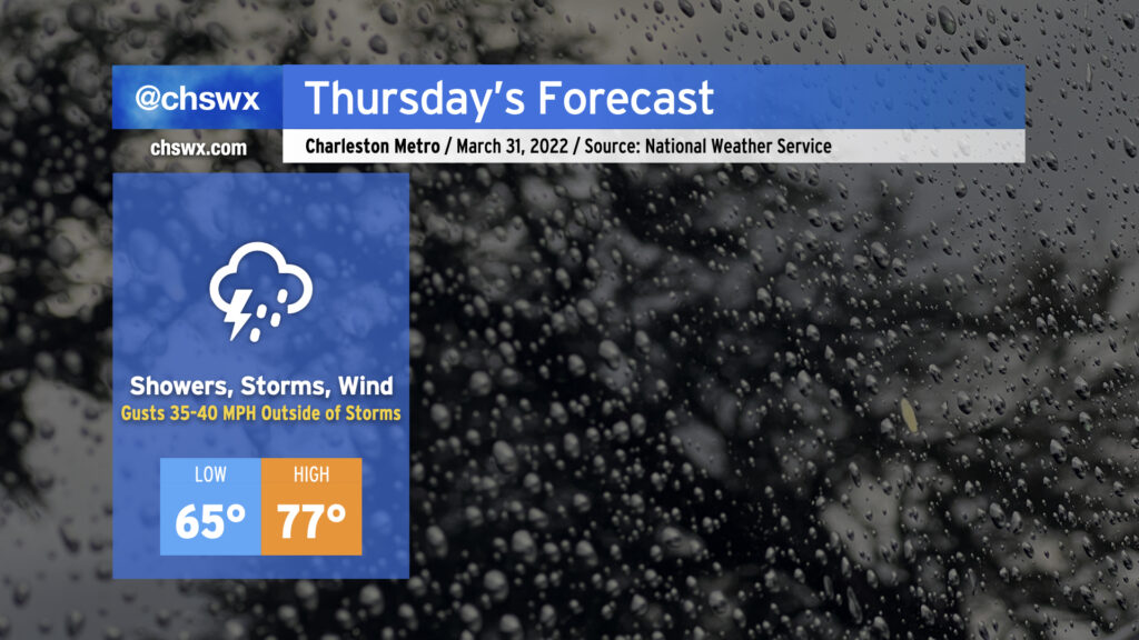
Thursday will turn stormy as a weakening squall line, which has produced a fair bit of severe weather across the Mid-South and central Gulf Coast states, gets into the area during the day Thursday. While widespread severe weather doesn’t look terribly likely thanks to a dearth of instability, the wind fields are such that thunderstorms might not need much in the way of vertical growth to generate some damaging straight-line winds. Indeed, outside of thunderstorms, gusts approaching 40 MPH will certainly be possible, especially on elevated surfaces such as bridges and overpasses. Low-level wind shear could briefly be supportive of a tornado, as well, but that risk is very low.
Expect showers possibly as early as 9-10am, with the best chance of rain and thunderstorms coming in the afternoon and early evening hours. Rain gear all day is a good call, but it’s not likely that any one spot will see rain all day, either.
Before rainfall arrives, temperatures will climb into the mid-to-upper 70s as warm air continues to pump into the area. Lows likely won’t drop below the mid-60s in most spots given the existing warm and moist airmass.
The good news is that this gets out of here relatively quickly, leaving nice and spring-like weather behind for Friday continuing into the Bridge Run on Saturday. The forecast for the run remains on track, with comfortable running temperatures and a light northeast breeze to maybe give you a little “oomph” on the Ravenel. (Lord knows I would need all the help I can get!)