More thunderstorms, a few on the strong side, possible on Wednesday
After what turned out to be a rather raucous and busy Tuesday in the weather department, we look to potentially have additional strong to severe storms develop on Wednesday as a warm front lifts northward across the area and mid-level energy comes up from the Gulf of Mexico. Instability should once again develop nicely, and with the assist from the pocket of energy aloft, there’s another shot at organized thunderstorms across the area. Severe weather should not be as widespread as it was today, but there will be the risk for damaging wind gusts, large hail, and even a tornado in the strongest storms. We could see a smaller but still organized line of thunderstorms come out of Georgia and move through the area in the 8-10 PM timeframe, so we’ll want to watch model trends on that carefully.
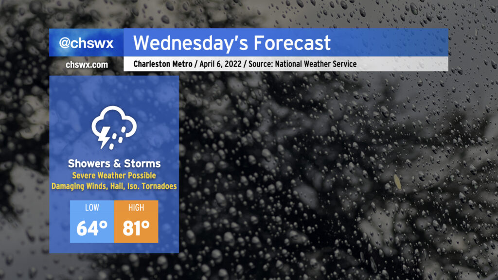
Outside of thunderstorms, it’ll be another warm and muggy day in the warm sector. Lows will bottom out just in the mid-60s, while highs should peak in the low 80s before thunderstorms develop.
Shower and thunderstorm chances will continue overnight into Thursday morning before a cold front sweeps this mess offshore, setting us up for a pleasant — if not a touch chilly! — Friday and the weekend.