Turning warmer on Tuesday with a few storms possible in the afternoon and evening
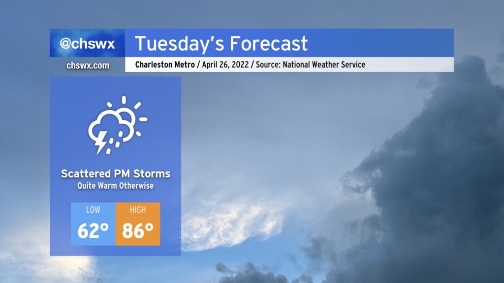
We have an even warmer day on tap for Tuesday before storms move in late in the afternoon into the evening ahead of a cold front. We’ll start the day in the low 60s before temperatures head to the mid-80s away from the cooler coastline. The warmest it’s been so far this year is 86° on February 23rd and again on February 25; we should tie this tomorrow. (The daily record high of 92°, set in 1989, is safe.)
We’ll be watching a cold front move into the area throughout the day Tuesday. Scattered showers and thunderstorms are expected to develop ahead of this front, with brief periods of heavy rain and gusty winds the main concern. There’s a low risk that a storm could produce a damaging wind gust or two, but severe weather doesn’t look to be a big concern with tomorrow’s front.
Rain should clear the area with the front by daybreak Wednesday, leaving behind cooler, drier air and overall pleasant weather for the next couple days. High pressure shifts offshore thereafter, and a warming trend will commence heading into the weekend. We could be in the mid-80s again by Sunday with a slight storm chance to go with it. Overall, though, quiet weather remains the rule as we head into the second half of the week.