The week ahead: Wet pattern draws down, warmth heads back up
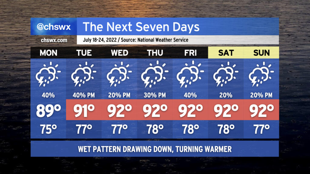
We will begin to see the widespread rain that’s punctuated the first half of July draw down a little bit this week as ridging aloft nudges back into the area. We’ve still got a couple days of periodic showers and thunderstorms to come, with another round of morning rain possibly in the cards for Monday, but overall the trend is a little drier. Of course, this is July, so nobody wins — we trend a little drier, and so temperatures trend a little more upward as the ridge builds overhead. Highs in the low 90s will be common, and with stifling humidity looking to continue, heat indices should be well into the 100s and may breach 105° several times this week. (The heat advisory criteria beginning July 1 is a heat index of 110° for two hours, so that’s why there’s no mention of Heat Advisories right now.) When storms do fire, they’ll be capable of dropping some heavy rain. Widespread severe weather isn’t expected, but you can never rule out a microburst or two this time of year. Overall, fairly standard mid-July fare is anticipated. Stay cool as best as you can — remember, frequent shaded breaks, lots of water.