Rest of the work week: Rain chances ramp up to close it out
Unsettled — but somewhat cooler — weather continues this week, particularly Thursday into Friday as areas of low pressure along a lingering front as well as impulses around a persistent upper trough help enhance rain chances across the area.
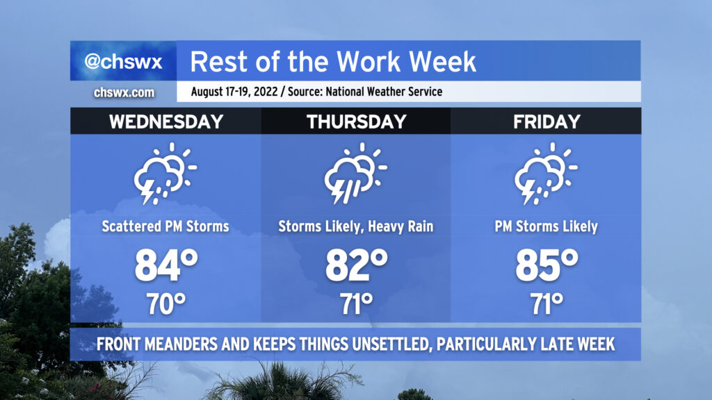
Wednesday will be the driest of the set. As of this writing, the front is driving southward into Georgia, and should stay to our south for much of the day, keeping us in cooler and slightly drier air. While this won’t totally suppress the risk for afternoon showers and thunderstorms, it certainly will keep coverage generally isolated to scattered at best for the first day of school in Charleston County. Highs will top out in the mid-80s, which should make for a reasonably nice day all things considered (though dewpoints around 70° will still feel muggy).
Rain chances begin to ramp up late Wednesday night into Thursday as surface low pressure moves along the front, drawing the boundary a little more north. At the same time, the trough aloft pivots enough to put us in the right entrance region of a jet streak, helping to enhance lift. This combination will make for an unsettled Thursday, with scattered to numerous thunderstorms expected across the area. Heavy rain will be a concern, and we’ll need to keep a close watch for isolated flooding potential. The widespread rain and onshore flow just behind the stalled front should keep Thursday’s high temperatures suppressed to the low 80s.
Friday will run a touch warmer (mid-80s) with a little less coverage of storms to start the day, but showers and thunderstorms become likely in the afternoon after mixing some daytime heating in along with the specter of additional disturbances rounding the base of the upper trough and the persistent stalled front. Heavy rain will once again be a concern with the strongest storms.
This unsettled pattern looks to persist into the weekend as the front continues to meander and weaken, while temperatures turn warmer, closer to mid-August norms.