Rest of the work week: A little lull, then turning soggy again
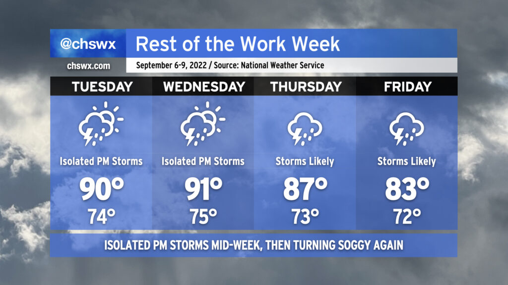
We’ll get a break in the more widespread rain as we head back to work and school on Tuesday as the surface configuration briefly turns a little more summer-like. We won’t stay completely rain-free — isolated to widely scattered showers and thunderstorms will be possible in the afternoon — but it certainly will be a bit of a shift from where we’ve been. The lower shower and storm coverage means temperatures will head to the low 90s in the afternoon; mix in the humidity and it’ll feel closer to 101-102°. We’ll repeat this on Wednesday before another front moves into the area by Thursday. Said front will once again stall out nearby — just not enough oomph yet to get these through at this point in the season — and keep us very unsettled from Thursday through Friday and into the weekend. This will send temperatures down to the upper 80s on Thursday to the low 80s on Friday with numerous showers and thunderstorms expected each afternoon. Heavy rain will be possible, and we may not get out of this week without another bout with flooding somewhere in the metro. Stay tuned to forecast updates.