Isolated storms Wednesday, then turning more active with a flooding threat to close the work week
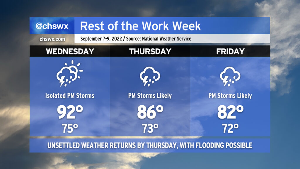
We will get one more day of relatively sparse thunderstorm coverage on Wednesday before the pattern becomes more active again starting Thursday. Highs will once again head into the low 90s across much of the area, and a few mid-90s readings can’t be ruled out either. 90s should reach all the way into downtown once again, too, as westerly winds pin the seabreeze to the immediate coast. As mentioned, a shower or storm can’t be ruled out in the afternoon and evening hours, with the best rain chances inland near an advancing cold front.
On Thursday, a strong influx of Gulf moisture opens up across the area. This, combined with the aforementioned front coming through and subsequently stalling out, will keep us quite unsettled as we head into the weekend. Temperatures will be modulated back to the mid-80s as numerous showers and thunderstorms should develop by afternoon. Friday remains unsettled as well, and some guidance suggests that could be a particularly rainy day, perhaps suppressing highs to the low 80s at best.
We will need to keep an eye on Thursday and Friday evening’s high tides for the potential for salt water flooding, too. Onshore flow combined with the upcoming full moon should drive water levels over 7′ each evening. These tides combined with the potential for heavy rain could spell another round or two of trouble for downtown Charleston — certainly something that will be watched quite carefully over the next few days. Stay tuned for forecast updates as rain timings and amounts become a little clearer as we get those soggier days into range of the higher-resolution model suite.