Friday and the weekend: Much warmer than normal
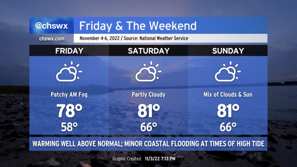
Even warmer weather is in the forecast for Friday and the weekend as high pressure at the surface slips offshore and winds turn southerly. Friday will still have a semblance of a fall feel, at least in the morning, as lows dip into the upper 50s ahead of highs in the upper 70s in the afternoon.
Thereafter, a more southerly component of wind begins to kick in, and we will begin to see temperatures (and humidity) kick up another notch. Saturday and Sunday will both start in the mid-60s — some 15° above normal — with highs reaching into the low 80s each afternoon. We’ll get close to record high minimums this weekend, but don’t anticipate breaching those. (The record high minimum for Saturday is 69°, and for Sunday is 71°, both set in 2003 during a record warm stretch.) Rainfall should be largely a non-issue, though a shower or two can’t be ruled out from time to time especially later this weekend as some upper energy interacts with a surface trough to our west.
The upcoming full moon and continued onshore flow will contribute to minor coastal flooding around times of high tide beginning Friday evening. More substantial coastal flooding will be possible as we head into next week as we watch for the potential for low pressure to develop in the western Atlantic, cranking the pressure gradient and northeasterly winds. This low could drive rain chances up in our neck of the woods as well, but the forecast extent of the rain still needs some finesse. Stay tuned this weekend for updates.
If you’re looking for a return to that fall feel that we had for a couple weeks in October, you may be waiting a little while: above-normal temperatures are favored through mid-month in the eastern third of the continental US. There are some signs that the pattern might change as we head toward Thanksgiving and beyond — stay tuned, though.