Tonight into Friday: Tornado threat, heavy rain at times, windy
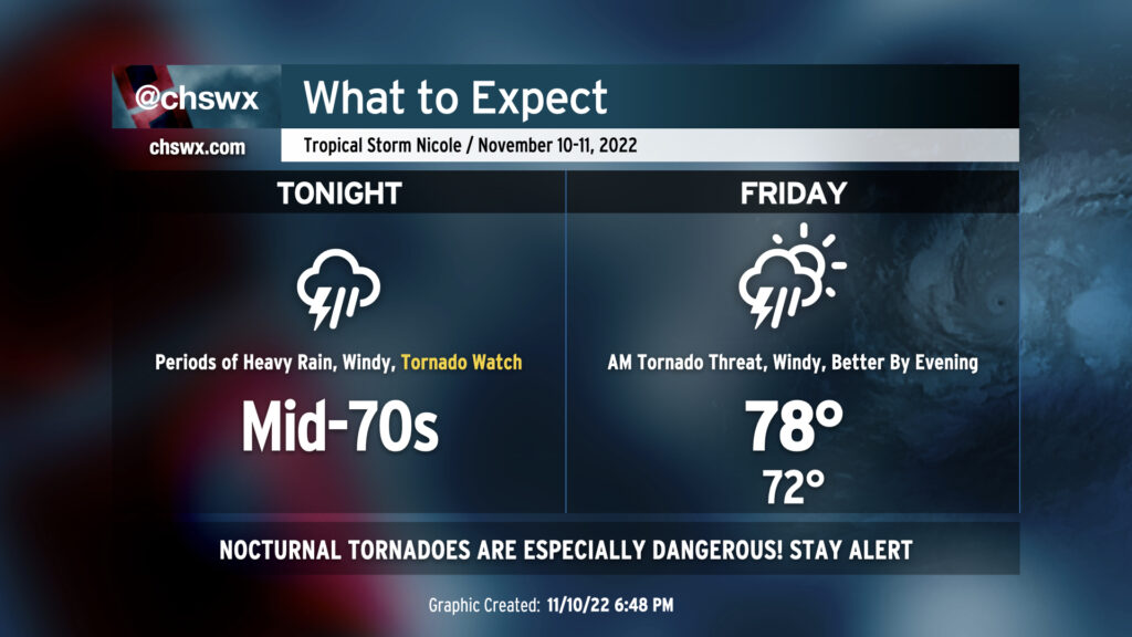
We have a potentially very busy 18-24 hours of weather ahead as Tropical Storm Nicole makes the turn to the north and the northeast overnight into Friday, keeping us on the “dirty” side of the storm. The main concern is overwhelmingly the threat for tornadoes overnight. A Tornado Watch is in effect until 1am, and it wouldn’t be surprising to see it extend even beyond that. Secondary to this will be the continued risk for heavy and potentially flooding rain at times, with gusty winds also a concern.
Tonight
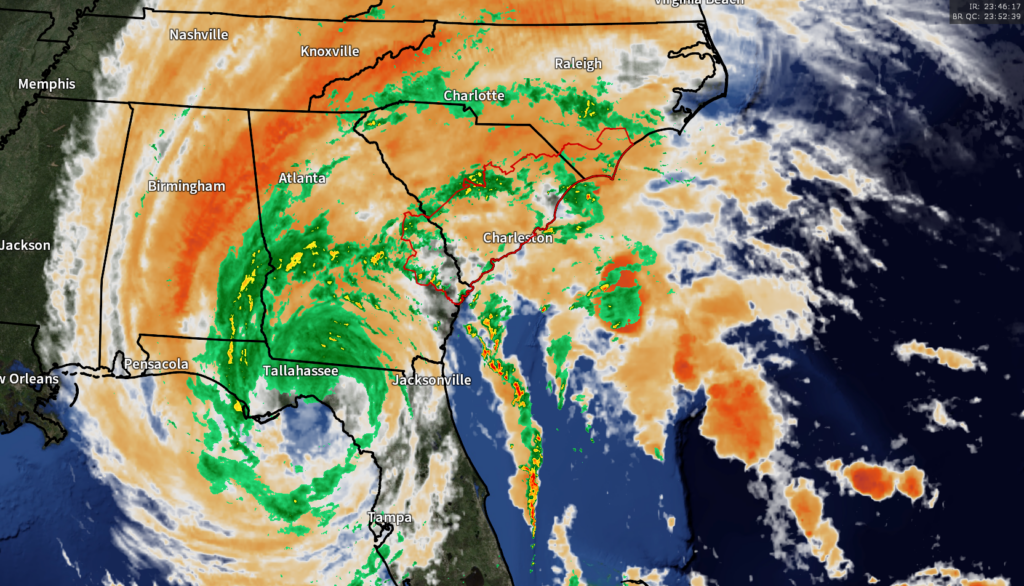
The overriding concern is the threat for tornadoes tonight. A potent feeder band stretching from just offshore West Palm Beach, FL up through the Atlantic into Savannah, GA will rotate into the Lowcountry later tonight, and with this band will come probably the best risk for a tornado or two given very favorable shear and more than ample instability. It will likely move into the area sometime after 9PM and should come with heavy downpours and gusty winds in addition to a tornado threat. It’s imperative that you have two ways to get warnings that can wake you — a NOAA Weather Radio is ideal, and a cell phone with Wireless Emergency Alerts will serve you well, too.
Temperatures are not gonna move much — it’s going to be a pretty muggy night with temperatures running in the mid-70s, something that will feel so much more summerlike than November.
Friday into the weekend
We’ll start Friday with the risk for some minor salt water flooding and perhaps some additional storms spiraling through the area. Nicole (or its remnants) will be passing to our west and northwest, accelerating to the northeast throughout the day as it gets picked up by a trough. The tornado threat will linger through the morning, but once Nicole gets a little more north of our latitude, that risk will move into the Grand Strand and eastern North Carolina.
Water levels in the harbor will approach 7′ around the 9:29 AM high tide. Winds should be turning less and less favorable for coastal flooding by that time, but lingering elevated seas from Nicole will help to keep close to the coastal flood threshold. There’s still the potential for some heavy rain bands to move by the area, too, so we’ll need to watch for a freshwater flood threat from rainfall.
By evening, dry air wrapping around Nicole will punch into the area, shutting off the rain and starting to break the cloud canopy a bit. When this happens, winds will turn a little stronger, with gusts 30-40 MPH common throughout the area particularly during the day. Winds will slacken by late evening, yielding what will be a good weekend of weather: a seasonably mild Saturday followed by much cooler temperatures Sunday in the wake of a strong cold front.
Follow my Charleston Weather updates on Mastodon, Bluesky, Instagram, Facebook, or directly in a feed reader. Do you like what you see here? Please consider supporting my independent, hype-averse weather journalism and become a supporter on Patreon for a broader look at all things #chswx!