Rest of the work week: Storms Wednesday, then cooling off
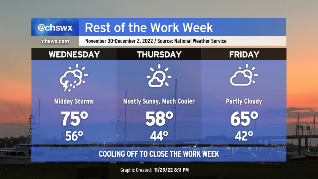
Our next rain chance arrives tomorrow as a strong cold front moves through the area. Expect a band of showers and maybe a few rumbles of thunder to roll through the area roughly from sunrise to mid-afternoon. (Exact timing of these lines can be a bit of a challenge, hence the range.) While wind shear will be decent, instability will be sorely lacking, and so there’s very little concern for any severe weather from this system (unlike what folks in Louisiana and Mississippi have seen this evening). We won’t get a whole lot of rain this go-around, either — generally expect a tenth to a quarter-inch of rain, with slightly higher amounts around I-95 and points west. Temperatures will jump into the mid-70s early in the day with warm air pumping into the area ahead of the front.
Said front will lag the rain by a few hours, but it should get through around or after sunset Wednesday, yielding a much cooler day on Thursday. Expect highs in the upper 50s on Thursday despite almost full sunshine. It’ll be a little breezy, too, so you’ll want the hoodie or light jacket.
Temperatures rebound a little on Friday after starting in the low 40s. We’ll see highs top out in the mid-60s with a few more clouds in the area, but still plenty of sunshine and a little lighter winds to enjoy a nice Friday outdoor lunch. From there, the 70s return and hang around for a few days through the weekend into early next week — not exactly the most December-like way to start December, but that’s how things go around these parts.