Friday & the weekend: Mix of sun and clouds, with temperatures peaking Saturday
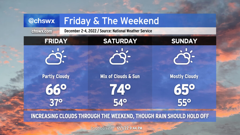
We’ll see a mix of clouds and sun this weekend with a bit of a temperature rollercoaster as a front looks to sag south of the area on Sunday.
Friday will bring a very chilly start — lows in the mid-30s across much of the metro, with colder temperatures perhaps approaching freezing in some spots. Light northeast winds will make it feel a few degrees cooler, too. (Make sure pets and plants are inside tonight.) Highs in the afternoon will rebound to the mid-60s, about 5° or so warmer than we saw on Thursday. Expect scattered to broken cloud cover.
Saturday will turn warmer ahead of the aforementioned front, as highs will peak in the mid-70s. We’ll see a mix of clouds and sun continue with showers generally dissipating before they arrive.
The front should sag south of the area by Sunday, knocking temperatures back down about 10° in the afternoon with highs only peaking in the mid-60s. Showers are unlikely, though we’ll want to keep an eye out Sunday night given some model disagreement. That being said, the bulk of the weekend should get in generally rain-free, and while we might want to see more in the way of sunshine, it won’t be too bad at all.