The week ahead: Much warmer than normal at times with periods of showers

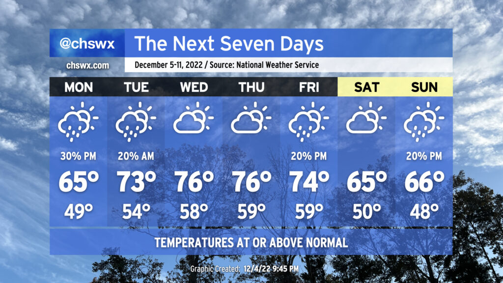
The main weather story of the week ahead will be how non-December-like it will feel, with highs running some 10°+ above normal for much of the work week as we sit between fronts.
High pressure will continue to wedge into the area from the northeast on Monday, keeping temperatures around normal with some cloud cover around. A little energy aloft will ripple through the area starting in the afternoon, generating some scattered showers that could last through Tuesday morning (especially if the NAM’s depiction of a weak surface wave developing offshore comes through). Winds then turn more southerly as high pressure shifts offshore, helping temperatures reach up into the low 70s Tuesday afternoon. Mid-70s continue through Friday ahead of another cold front, which could bring a few showers to the area but should otherwise get through with little fanfare. Temperatures turn closer to normal for the weekend (mid-60s for highs) with another shower chance Sunday as another front approaches.
Looking for cold weather? You’ve gotta peek almost into model fantasyland to find any of that at this point. There’s some general agreement on a sharper cooldown sometime in the middle of next week, but the degree to which it’ll cool off and the timing of said cooldown is impossible to know at this range. Stay tuned…
Follow my Charleston Weather updates on Mastodon, Bluesky, Instagram, Facebook, or directly in a feed reader. Do you like what you see here? Please consider supporting my independent, hype-averse weather journalism and become a supporter on Patreon for a broader look at all things #chswx!