Rest of the work week: Quick warmup, then some rain, then cooling off
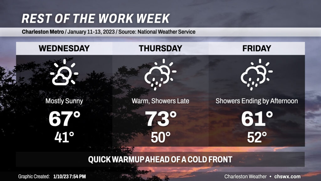
The rest of the work week will feature a quick warmup (with a brief return to the 70s on Thursday) before a cold front brings temperatures back down to earth for Friday and the weekend.
Wednesday will feature a continuation of the mostly sunny skies we saw on Tuesday. We’ll run a touch warmer than we did Tuesday, with lows bottoming out in the low 40s and highs topping out in the mid-to-upper 60s in the afternoon.
A cold front will draw nearby on Thursday. Southerly flow ahead of the front will bring warmer air into the area, with highs topping out in the low 70s in the afternoon after starting around 50°. Cloud cover and eventually showers will show up in the afternoon, with the bulk of the rain falling after sunset and likely overnight.
We could still be contending with some showers during the first half of the day Friday, but they’ll be on a tapering trend as the front moves offshore. Behind the front, we’ll see highs top out only in the upper 60s, about 10 or so degrees cooler than Thursday. From there, skies clear out nicely for what will be a chilly weekend, with even a few lows around freezing on Sunday.
Follow my Charleston Weather updates on Mastodon, Bluesky, Instagram, Facebook, or directly in a feed reader. Do you like what you see here? Please consider supporting my independent, hype-averse weather journalism and become a supporter on Patreon for a broader look at all things #chswx!