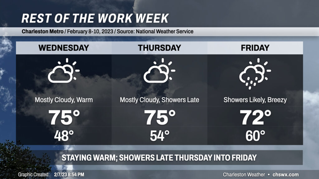
Rest of the work week: Staying warm, turning showery

We stay in the 70s for the rest of the work week ahead of a storm system that will cool us back off for the weekend. Cloud cover increases Wednesday, but that won’t stop temperatures from heading even warmer than they did Tuesday with highs expected in the mid-70s. Thursday should represent the peak of the warmth, with solid mid-70s expected across the area ahead of the storm system. Showers look to begin late Thursday and will last into Saturday morning, with the main rain event on Friday. Highs will still top out in the low 70s on Friday after starting the day in the low 60s — closer to the average high for February 10 as opposed to the average low. Once the front is through later Friday/early Saturday, temperatures will head back to a little below normal for the weekend.