Soggy weekend ahead with flooding concerns Saturday
A wet weekend — particularly Saturday — lies ahead as a cold front stalls to the south and a lumbering upper low moves slowly through the area.
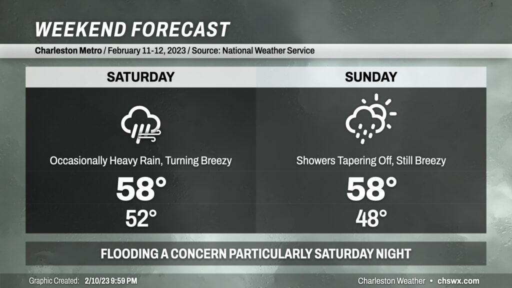
A cold front will come through late tonight into early Saturday morning and then stall out to our south. A wedge of high pressure will fill in behind it, and a strong feed of Gulf moisture atop said wedge will drive lots of overcast and rainfall across the area Saturday. Temperatures will optimistically head into the mid-to-upper 50s, but as we know from these kinds of cold air damming scenarios that we can often bust much cooler. Bottom line: Be ready for chilly rain for much of Saturday.
Later in the day Saturday, a wave of low pressure may develop along the stalled front. This could nudge some instability inland and allow for more convective rainfall to develop particularly near the coast and around downtown. Some fairly heavy rain rates are possible on top of what would have already been a soggy day if this can materialize, bringing with it a risk for flooding for Saturday night into early Sunday morning. We’ll want to watch this trend very carefully. Winds will also gradually be kicking up, and gusts 30+ MPH will be possible beginning late afternoon through evening. Wet soils and stronger winds could contribute to some isolated power outages.
The surface wave will be northeast of the area by Sunday morning, while the upper low moves slowly across the Carolinas throughout the day. This will keep temperatures on the cool side — highs in the mid-to-upper 50s — and showers in the forecast for much of the day, though the deeper plume of moisture will be well out of our way, ending the flooding threat. We should see some breaks in the clouds later in the day, but otherwise skies will remain primarily overcast. Winds will remain on the breezy side, with sustained west winds 15-20 MPH common in the wake of the surface low.
As has been custom so far in 2023, the weather clears out just in time..for Monday. (Boo.) We could approach 80° at some point next week, too — a helpful warm thought as we go through some cold rain over the weekend.
Follow my Charleston Weather updates on Mastodon, Bluesky, Instagram, Facebook, or directly in a feed reader. Do you like what you see here? Please consider supporting my independent, hype-averse weather journalism and become a supporter on Patreon for a broader look at all things #chswx!