The week ahead: More record-threatening temperatures, but changes are coming
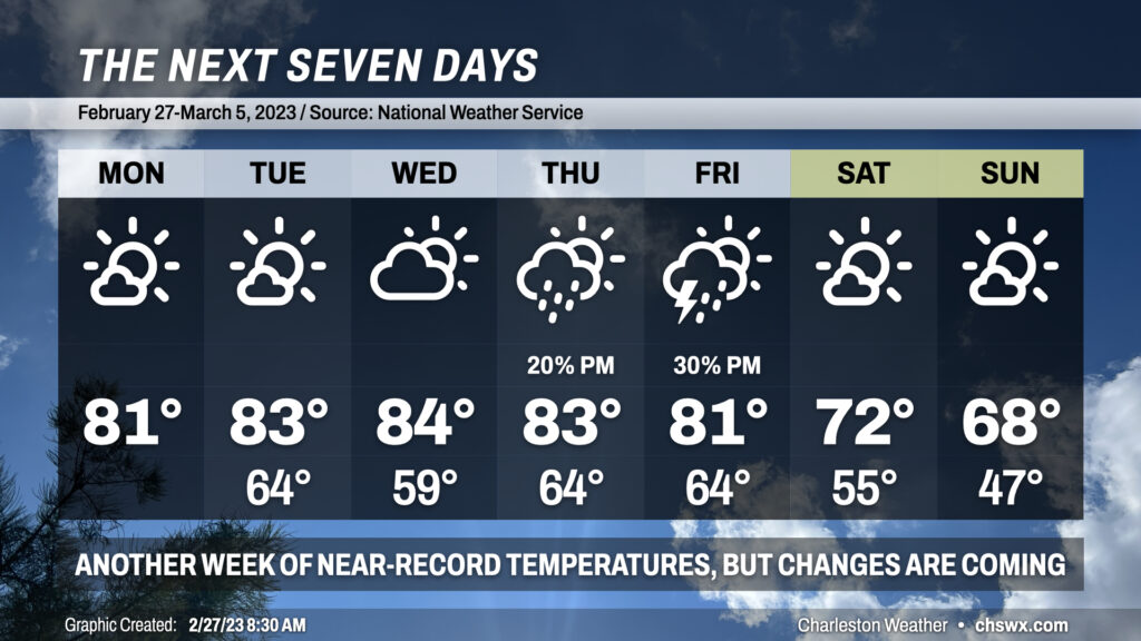
We’re back in the 80s starting today as much warmer-than-normal temperatures continue across the Lowcountry. We may once again threaten record highs over the next few days with temperatures topping out in the low to mid-80s each day through Friday. Lows in the mid-60s most days (except for Wednesday, the result of a weak front) will also challenge record high minimum temperatures across the region — indeed, this remains unusually warm weather for this point in the year and The Pollening should, unfortunately, continue apace.
Changes are coming later this week for the weekend, though. A strong cold front looks to approach the area Thursday into Friday, which will shift the airmass more substantially and get temperatures back within striking distance of early March normals. This will come with the risk for strong to severe thunderstorms on Friday afternoon, with strong winds expected even outside of thunderstorms. We’ll want to watch this closely for later this week, but there’s still model difference right now in the exact track of the storm system. Stay tuned.
Regardless of what pans out with the severe weather threat, we’ll have a much more seasonable — but still warmer-than-normal — weekend ahead with highs topping out in the low 70s Saturday and the upper 60s on Sunday. Lows will fall back to earth as well, with the first lows in the 40s since February 20 in the forecast. The good news in all this is that we should see plenty of sunshine this weekend to go along with the more comfortable temperatures. (Just take some precautions against the pollen if you are sensitive to it.)