Weekend forecast: Showers ending Saturday, record books safe
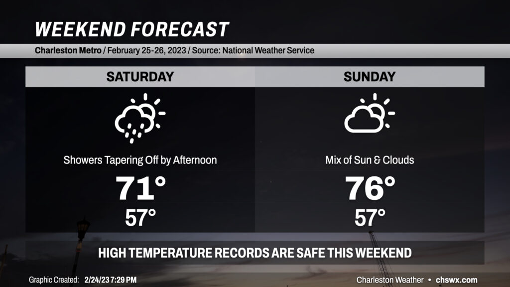
Our recent string of record warmth, punctuated by a high of 86° today that breaks last year’s record of 84°, takes a pause this weekend as a backdoor cold front stalls out near the area. Showers filling in tonight will peak overnight as low pressure develops along the coast. As this low pressure pulls away during the day Saturday, so will the chance for rain. Bottom line for precipitation: Keep rain gear handy, but you may not end up needing it. Cloud cover and high pressure wedging in from the north will keep temperatures well below where they have been recently, but still above normal, peaking in the low 70s.
Said front lifts back north of the area on Sunday, bringing in a little more in the way of sunshine and warming temperatures back into the mid-70s. This is roughly 10° above normal for this point in the year, but the record books will remain intact as the record high of 83° set in 1996 looks to remain safe. By Monday, we should be back into the 80s as ridging re-establishes itself aloft.