The week ahead: Quiet start, turning unsettled the second half of the week

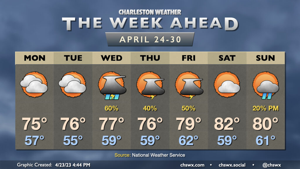
We get the week started with quiet, if not somewhat cloudy, conditions across the area. We then turn more unsettled from Wednesday on.
Cloud cover will factor in somewhat prominently for the first couple days this week, keeping highs capped to the mid-70s — a few degrees below normal for this point in April. Despite the cloud cover, we stay rain-free through Tuesday. This changes Wednesday, though, as the pattern turns a little more unsettled to close out the work week. Showers and a few thunderstorms become likely in the evening in particular as high pressure erodes from east to west throughout the day, allowing a more warm and unstable airmass to move into the area.
A series of low pressure systems then move across the area Thursday into Friday, keeping shower and thunderstorm chances in the forecast. It won’t rain all the time, but there will be periods of showers and storms at any point each day. Temperatures will remain at or a little below normal through Friday given the periodic showers and thunderstorms.
We look to get a break in the action for Saturday; this’ll allow temperatures to head into the low 80s in the afternoon under partly cloudy skies. We stay rain-free into Sunday afternoon before slight shower chances return to the forecast later in the day.
Follow my Charleston Weather updates on Mastodon, Bluesky, Instagram, Facebook, or directly in a feed reader. Do you like what you see here? Please consider supporting my independent, hype-averse weather journalism and become a supporter on Patreon for a broader look at all things #chswx!