Rest of the work week: Below-normal temperatures continue

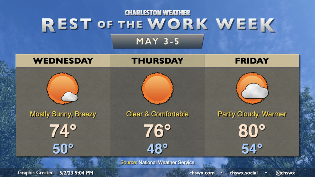
The rest of the work week will continue with plenty of sunshine and below-normal temperatures. We’ll start in the upper 40s to around 50° on Wednesday before temperatures only get up to around the mid-70s despite nearly unfettered sunshine. It will feel quite nice outside, but you’ll still want to mind the breeze that could push 20 MPH at times with higher gusts.
Winds finally slacken Thursday as we get to probably the best day of the set. We start again in the upper 40s to around 50° before temperatures head up into the mid-70s in the afternoon with nary a cloud in the sky. It really should be a great day to try to get some things done outside as best as you can given it’s a weekday.
Winds will go a little more southerly late Thursday, and this will persist into Friday. Temperatures will warm as a result, with lows in the mid-50s expected to start the day and highs topping out around 80°, closer to — but still a touch below — normal for Cinco de Mayo. The southerly flow will bring a little more moisture into the area as well, and we should see more of a scattered cumulus deck as a result. Still, we’ve got plenty of sunshine in store.
The next rain chance will, of course, be this weekend: isolated to scattered showers and maybe a thunderstorm will be possible Saturday afternoon; these slight shower chances persist into Sunday morning. No rainout is expected, though. Temperatures will still run at or slightly below normal, generally around 60° to start with highs topping out around 80° each day.
Follow my Charleston Weather updates on Mastodon, Bluesky, Instagram, Facebook, or directly in a feed reader. Do you like what you see here? Please consider supporting my independent, hype-averse weather journalism and become a supporter on Patreon for a broader look at all things #chswx!