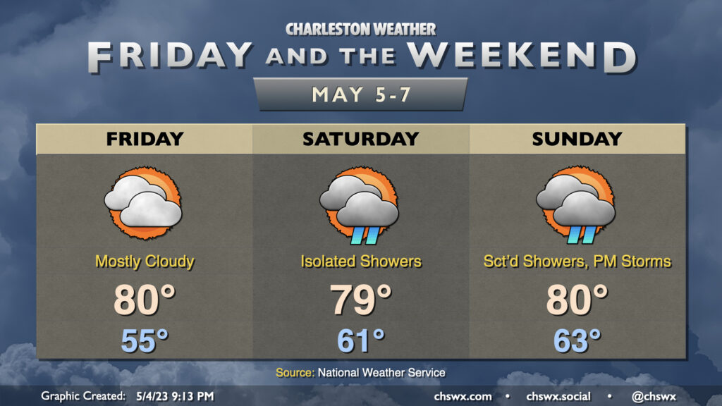
Friday & the weekend: Shower chances return

Allow me to revise the list of life’s inevitabilities as of 2023: Death, taxes, and shower chances over the weekend. A slow-moving front will be the latest culprit, keeping isolated to scattered showers on our mind each day this weekend. (It’s worth noting, though, that a total washout is not expected!)
Friday will, at least, remain rain-free, but the increase in cloud cover will be noticeable as high pressure slips offshore and moisture return begins. Highs top out around 80° after starting in the mid-50s — the last truly crisp morning for the foreseeable future.
Isolated showers will be possible Saturday as a warm front lifts north and then stalls out in the area. We could see a thunderstorm or two in the afternoon as well, but the best risk for that will be a little further inland. Highs on Saturday top out in the upper 70s to around 80° under mostly cloudy skies outside of any showers.
Shower coverage will increase a little for Sunday, particularly in the afternoon as the seabreeze moves inland. A thunderstorm or two can’t be totally ruled out, either. We’ll start the day in the low 60s before temperatures head to about 80° in the afternoon.
As we look beyond the weekend, we are looking at a pretty solid shot of late-spring warmth across the Lowcountry. Highs could approach 90° at some points early next week! So far, the warmest days this year have been March 7 and April 19; on both days, temperatures topped out at 87°. It’s a good reminder that summer is indeed just around the corner…
Follow my Charleston Weather updates on Mastodon, Bluesky, Instagram, Facebook, or directly in a feed reader. Do you like what you see here? Please consider supporting my independent, hype-averse weather journalism and become a supporter on Patreon for a broader look at all things #chswx!