The week ahead: Warm and unsettled

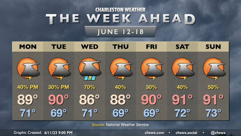
Warm and unsettled weather will be the rule for much of the week ahead as a trough of low pressure aloft hangs around for much of the week, driving a front close to the area before it stalls out and meanders before washing out over the weekend.
Heat and humidity certainly will make an appearance this week. Highs for much of the week should be close to 90°, with the exception of Wednesday when greater thunderstorm coverage is expected as shortwaves aloft interact with a stalled front that’ll be draped over the area. Mix in humidity and it’ll feel solidly like the low-to-mid-90s each day before thunderstorms do their thing.

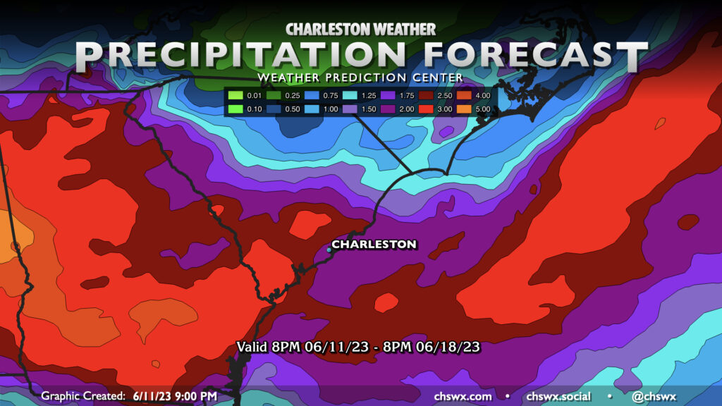
With plenty of available moisture comes a good opportunity for some healthy rainfall this week. Generally, expect 2-3″ of rain to have fallen across the Tri-County by the time Sunday evening rolls around. Some spots, of course, will see locally higher amounts, and others may not see quite as much. There’s no ongoing drought in our part of the Lowcountry, though we are running about 2″ behind for the year on rain, so this week should help keep us on pace for a normal rainfall year so far.

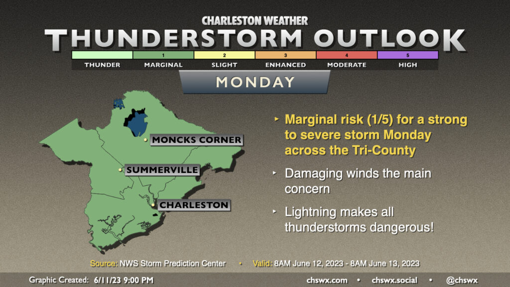
There will also be the risk for some stronger storms at times this week. Sufficient shear and decent instability should allow for a storm or two to become severe on Monday, with damaging wind gusts the main concern. The Storm Prediction Center outlook currently outlines the entire area in a marginal (1 out of 5) risk for severe weather, and this seems sound. As always, lightning makes every thunderstorm dangerous — when thunder roars, go indoors!
Follow my Charleston Weather updates on Mastodon, Bluesky, Instagram, Facebook, or directly in a feed reader. Do you like what you see here? Please consider supporting my independent, hype-averse weather journalism and become a supporter on Patreon for a broader look at all things #chswx!