Friday & the weekend: Warm, with a slight chance of a storm in the afternoons

Here comes real summer: Humidity begins to increase Friday as winds go more southerly at the surface, and will continue to build heading into the weekend. Highs on Friday top out in the mid-90s once again, and with dewpoints just shy of 70°, expect heat indices to approach 100° in the afternoon. We could see a shower or storm in the afternoon to evening hours along the seabreeze (and possibly as a result of a decaying convective complex headed toward the Carolinas), but most of us should stay dry.
Similar weather is on tap for Saturday, but with dewpoints a few clicks higher, expect heat indices to top out around 102° or so. Once again, we could see a shower or storm in the afternoon, but the vast majority of us should get away with the day rain-free.
By Sunday, dewpoints will top out in the mid-70s, and this combined with solid mid-90s temperatures could drive heat indices near 110°, which is the Heat Advisory threshold after July 1. A stray shower or storm can’t be ruled out, but the odds favor dry weather for now. We’ll want to keep an eye on potential thunderstorm complexes rounding a ridge of high pressure that’ll be making gradual eastward progress toward the area, so stay tuned to forecast updates as these are hard to catch beyond a day or so.
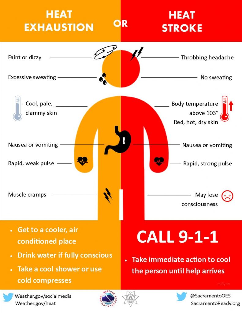
Heat safety

With the first real shot of summer weather headed our way this weekend, it’s important to be aware of the signs of heat exhaustion and heat stroke. Heat stroke is a 911-worthy emergency! Make sure to take plenty of breaks in shady, cooler spots, drink plenty of water, and just overall take it easy if you must be outside during the peak of each afternoon.
Follow my Charleston Weather updates on Mastodon, Bluesky, Instagram, Facebook, or directly in a feed reader. Do you like what you see here? Please consider supporting my independent, hype-averse weather journalism and become a supporter on Patreon for a broader look at all things #chswx!