The week ahead: A climatologically normal last week of July

Believe it or not, it’s already the last full week of July. Climatologically speaking, this week’s forecast is about as end-of-July as it gets: Mid-70s lows each morning, low 90s highs each afternoon with isolated to scattered afternoon thunderstorm chances as the trough that made Sunday in particular quite unsettled lifts out and ridging begins to build back in.
Monday could offer up some slightly better shower and storm chances during the day as a little spin remains in the atmosphere, but a repeat of Sunday’s deluge (more on that in a minute) is certainly not in the cards with generally scattered coverage expected.
Mid-week will feature highs generally 92-93° with a few seabreeze showers and thunderstorms each afternoon in a very standard summertime regime with Atlantic ridging firmly in place. If anything, that will get even a little stronger as we head into the weekend; temperatures will respond appropriately by heading back into the mid-90s on Saturday and upper 90s on Sunday. Dewpoints won’t quite be as nasty as they were this past week, but low-70s dewpoints should still yield a period of heat indices 104-106°.
Record-breaking rainfall on Sunday

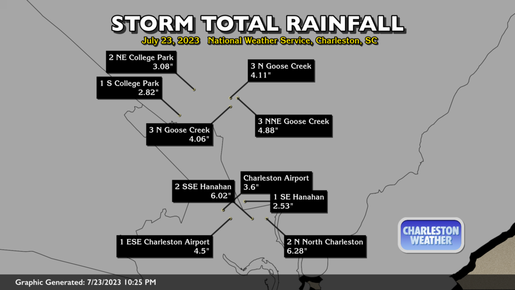
Sunday brought quite a deluge to much of the Charleston metro area; a rainfall record was set at the airport climate site with 3.67″ of rain (as of this writing, anyway), demolishing the record of 2.54″ set in 1941. Some stations in the Park Circle area of North Charleston recorded upwards of 6″ of rain, while many others in Hanahan, Goose Creek, and surrounding areas were in the 4″+ range. Much of this rain fell in just three hours’ time, too, making this all that much more impressive. Flooding was reported in the usual locations, though mercifully the tide didn’t factor in too much and the rain was fairly progressive as it moved through downtown Charleston. Thankfully, many of us get a few days to dry out.
Follow my Charleston Weather updates on Mastodon, Bluesky, Instagram, Facebook, or directly in a feed reader. Do you like what you see here? Please consider supporting my independent, hype-averse weather journalism and become a supporter on Patreon for a broader look at all things #chswx!