Friday & the weekend: A couple more unsettled days before another dry stretch
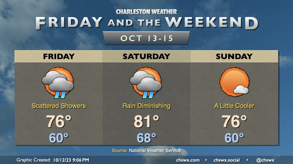
We stay unsettled — but turning warmer — on Friday as winds turn a little more onshore thanks to low pressure developing over northern Florida and southern Georgia. This will also help to keep showers in the area for a good bit of the day, so be ready with the rain gear just in case. Some breaks in the clouds may bring some sunshine, but cloudiness should remain the main feature. Expect highs to top out in the mid-70s.
Showers will continue heading into Saturday as low pressure moves northward across the Lowcountry throughout the day. The low should clear the area by afternoon, and from there, we should start to see some slightly drier air work into the area. There should be at least some peeks of sun Saturday afternoon, so the day’s not a total loss, and we’ll get to the low 80s — as warm as we’ll be for the foreseeable future, it’s worth noting.
A stronger cold front comes through overnight and brings a much better shot of cooler and drier air to the area for Sunday. That’ll help to clear some of the cloud cover out a bit and help highs top out only in the mid-70s in the afternoon. Cooler and drier air will continue to work in overnight Sunday, and we’ll have a stretch of cooler-than-normal temperatures for much of next week.