Rest of the work week: Sweater weather arrives
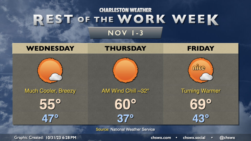
Legitimate sweater weather arrives Wednesday as the coldest air of the season thus far moves into the area. We start the day in the mid-40s but don’t expect temperatures to climb too much beyond the mid-50s despite lots of sunshine. In fact, we may at least tie a different kind of record high on Wednesday — the record low maximum temperature for November 1, which was also 55° last set in 2014.
Thursday looks to get off to the coldest start since early March, and a continued north to northeasterly breeze will drive the wind chill down to around or even below freezing. Dress accordingly in the morning! From there, highs will run a few degrees warmer than they did on Wednesday, but that’s not saying much as we’ll still see temperatures struggle to reach 60° despite unencumbered insolation. The record low maximum of 58° on Thursday is probably safe, but it’ll be close.
The airmass starts to moderate on Friday, though, as warmer air begins to work back into the area. We start Friday in the low 40s before warming to the upper 60s to around 70° in the afternoon under mostly sunny skies. The warming trend continues into the weekend, too, as we head back to the 70s each afternoon under partly cloudy to mostly sunny skies.
Coastal flooding threat to continue to taper
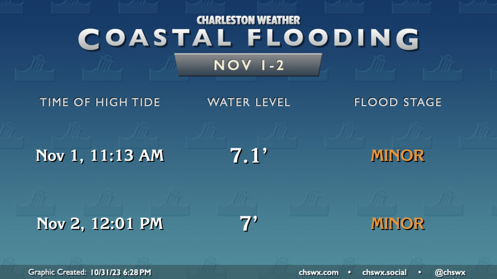
Astronomical effects from Saturday’s full moon continue to taper, and with winds starting to take on a more unfavorable trajectory post-cold front, we should see the risk for coastal flooding continue to diminish over the next few days. However, there will still be opportunities for some minor salt water flooding with the 11:13 AM high tide on Wednesday and the 12:01 PM high tide on Thursday. However, we are not expecting a repeat of the 7.55′ tide that happened Tuesday morning.
Tropics: Nothing to worry about
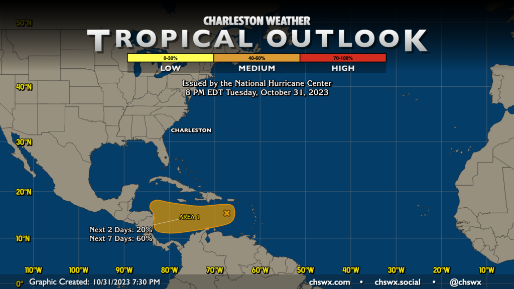
A quick peek at the Tropical Outlook map shows generally quiet conditions aside from an area in the southern Caribbean which has been tagged as Invest 97L. This area will continue to move westward over the next few days and affect Central America. It’s nothing for us to worry about.
The names Vince and Whitney remain up for grabs before we head to the supplemental list. Time will tell if one or both of those names gets claimed as we head into the final month of what has been another storm-laden hurricane season.
Follow my Charleston Weather updates on Mastodon, Bluesky, Instagram, Facebook, or directly in a feed reader. Do you like what you see here? Please consider supporting my independent, hype-averse weather journalism and become a supporter on Patreon for a broader look at all things #chswx!