Friday & the weekend: A few showers give way to generally quiet and cool weather
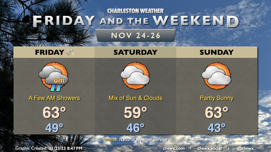
We’ll get Black Friday off to a bit of a cloudy and perhaps showery start as a disturbance ripples through the area, kicking up some patchy rains for a few hours Friday morning. From there, rain will depart and clouds will gradually break some, and we should end the day with some sunshine. We start Friday in the upper 40s and warm to the low 60s.
High pressure wedging southward will keep Saturday on the cool side under a mix of sun and clouds. Temperatures start in the mid-40s but may not crack 60° in the afternoon given the cool high pressure wedging into place. Sunday will represent the coolest start of the set with lows in the low 40s expected. However, we’ll warm to the low 60s in the afternoon as the wedge begins to weaken in advance of another disturbance for Monday. Still, high temperatures will run on the cool side of normal, so sweaters may be advisable.
Coastal flooding could be an issue Saturday and Sunday mornings. Water levels around the 6am high tide Saturday could reach 7.2′, while moderate coastal flooding is possible with Sunday morning’s 6:46am high tide as water levels could peak between 7.6-7.8′. We’re approaching a full moon on Monday, but the bigger driver of coastal flooding will be NE winds kicking up near the coast thanks to a pressure gradient between high pressure building in over land and low pressure spinning up offshore. Stay tuned for possible Coastal Flood Advisories from the National Weather Service.