Sunday’s forecast: Morning coastal flooding, then evening showers
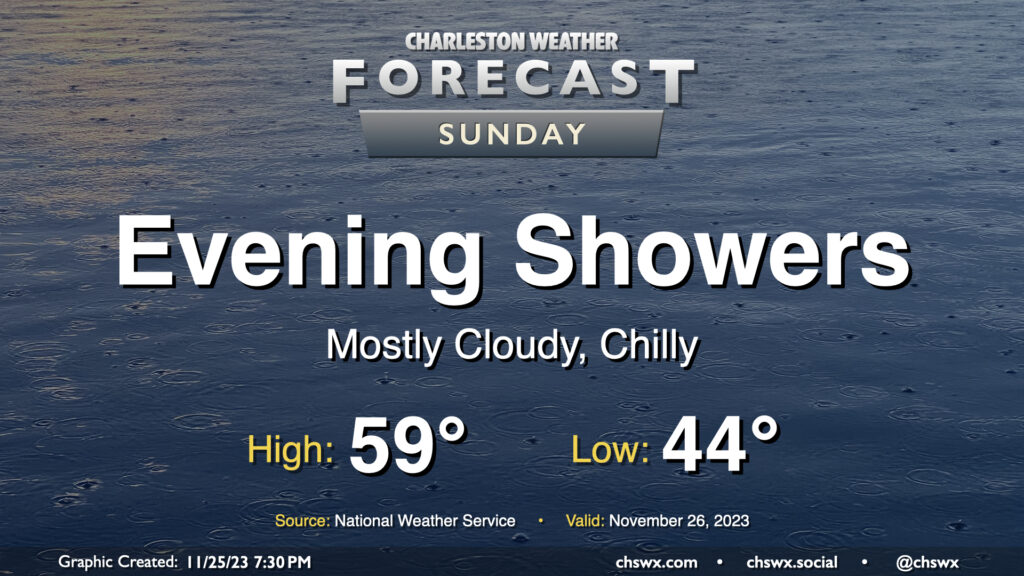
Sunday will feature more in the way of cloud cover as another disturbance affects the area. High pressure wedging southward will help keep things on the cool side as northeasterly winds continue to blow into the area. We start the day in the mid-40s and may not reach 60° in the afternoon thanks to the cloud cover. We should stay rain-free for the morning through early afternoon; from there, showers may begin to develop and move across the area. The best chance for showers will be in the evening as low pressure to the south makes the closest approach. Rainfall should generally be on the light side, but a few pockets of heavier rain certainly can’t be ruled out. Rain should clear the area by Monday morning as high pressure builds back into the area.
The other weather concern for Sunday will arrive early in the morning in the form of coastal flooding. Favorable northeasterly winds and astronomical effects the upcoming full moon will drive water levels into minor to possibly moderate flood stage around the 6:44am high tide Sunday. Salt water may close some roads as water levels approach 7.4-7.6′. If you have early-morning travel plans around the edges of the downtown peninsula, especially on the west side, prepare to reroute around flooded and closed roads.