Thursday: Cloud cover breaks, cooling trend begins
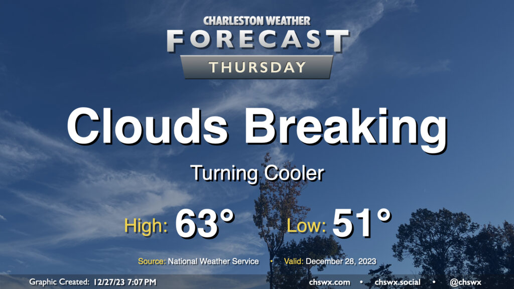
Thursday will be a much cooler day than Wednesday was across the Lowcountry, where most stations made it into the 70s at some point during the day, as an initial round of cooler and drier air infiltrates the area ahead of a reinforcing front which will really chill us out for Friday into the weekend. Dewpoints fall into the mid-40s throughout the night, allowing temperatures to drop generally into the low 50s to start Thursday. We’ll top out in the low-to-mid-60s in the afternoon — still a touch above normal — as clouds gradually start to break up along with the cold front’s passage.
Friday: Much cooler air arrives
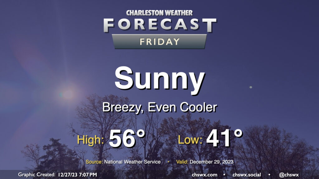
Friday looks to be a breezy day as much cooler air works into the area courtesy of sprawling high pressure building in from the west and a cutoff upper-level low meandering into the Southeast. Temperatures will start in the low 40s and struggle to the mid-50s despite full sunshine as temperatures around 4,600 feet drop below freezing along with the arrival of the upper low. The atmosphere will be largely devoid of any meaningful moisture, so this upper low shouldn’t squeeze out anything unexpected across our part of the Carolinas.
New Year’s weekend: Staying cool and quiet
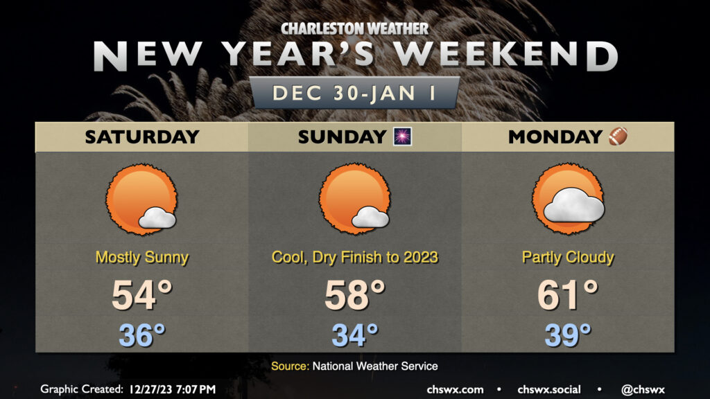
Quiet weather and cooler-than-normal temperatures will persist as we close out 2023. Saturday will be another particularly chilly day, with lows in the mid-30s yielding to highs in the mid-50s in the afternoon as the core of the colder air moves overhead. Steep lapse rates could produce a cumulus field, but it will be sparse given limited moisture.
New Year’s Eve gets off to an even cooler start, with lows flirting with freezing away from the coast, with mid-30s expected across a good bit of the metro. Temperatures will begin to moderate, though, as the upper low shears out and moves away, taking the core of the coldest air with it. This will allow highs to climb into the upper 50s — still a touch below normal for the last day of the year, but within striking distance at least. We’ll see a little bit of high cloud cover, but nothing that will totally obscure the sun. You’ll want a jacket if you’re headed out for New Year’s festivities, though, as temperatures will be falling back into the low-to-mid-40s by midnight.
New Year’s Day will run a little warmer ahead of another cold front. We still start the day in the upper 30s, but we should see temperatures top out right around 60-61° for the first day of 2024. This will break a streak of three consecutive years where we started the year above 70°, which included tying the record high of 80° in 2021.
Follow my Charleston Weather updates on Mastodon, Bluesky, Instagram, Facebook, or directly in a feed reader. Do you like what you see here? Please consider supporting my independent, hype-averse weather journalism and become a supporter on Patreon for a broader look at all things #chswx!