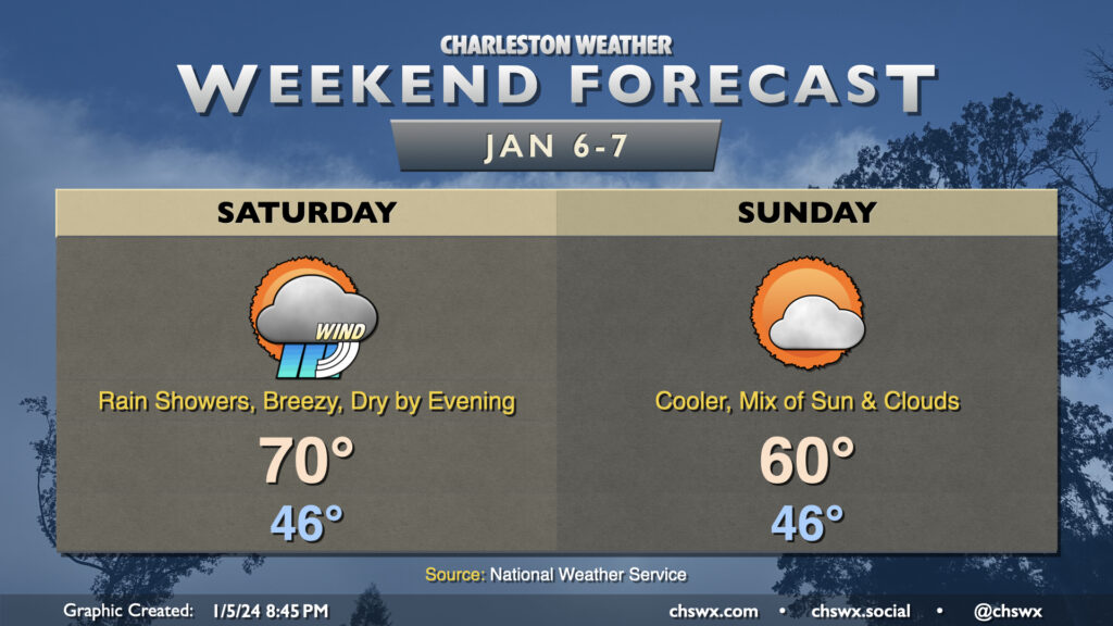
Weekend forecast: Rainy Saturday morning yields to a quiet evening and Sunday

We’ll likely be waking up to rain Saturday morning as a storm system moves through the area. Rain could be heavy at times, with a half-inch to an inch of rain possible in many spots. It’ll be windy, too: gusts to 30-35 MPH will be possible, so batten down the hatches if you have rain-or-shine outdoor events. The bulk of the rain should exit by early afternoon, though guidance does suggest some wrap-around moisture may keep a few showers around through early evening. From there, we should dry out. Temperatures during the day will be as warm as they’ve been so far in the small sample size of 2024: expect lows in the mid-40s to yield to highs near 70° in the afternoon as warm air advects into the area.
Sunday will be a quieter weather day, with cooler and somewhat drier air working into the area in the wake of Saturday’s storm system. Expect to start the day in the mid-40s with breezy westerly winds keeping highs capped to around 60° in the afternoon under a mix of sun and clouds.
Quiet through Monday, then a stormy day Tuesday

Monday will be another quiet day of weather, but Tuesday should be a decidedly different story as a potent (and deepening) low pressure system moving out of the mid-South into the Great Lakes region drags a front through the area Tuesday. While it remains a little premature to get into exact impacts, we can generally expect strong, gusty winds, heavy rain, the potential for a few severe thunderstorms, and a risk for coastal flooding. I’ll have more on specifics as we get closer to the event, but for now, be thinking about the potential for travel disruptions on Tuesday due to weather.
Follow my Charleston Weather updates on Mastodon, Bluesky, Instagram, Facebook, or directly in a feed reader. Do you like what you see here? Please consider supporting my independent, hype-averse weather journalism and become a supporter on Patreon for a broader look at all things #chswx!